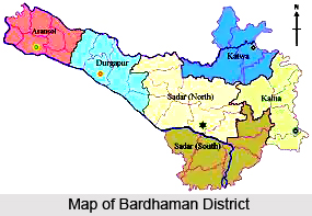
 Geography of Bardhaman District is mostly dealing red soil rich in iron and there exists anthracite and bituminous coal. Bardhaman district in the state of West Bengal extends from 22 degrees 56 minutes to 23 degrees 53 minutes North latitudes and from 86 degrees 48 minutes to 88 degrees 25 minutes East longitudes. Lying within Burdwan Division, the district is bounded on the north by Dumka (of Jharkhand), Birbhum district and Murshidabad, on the east by Nadia district, on the south by Hooghly, Bankura district and Purulia district and on the west by Dhanbad (of Jharkhand) districts. The western boundary of the state is formed by the Barakar River. The Ajay River separates Birbhum and Dumka to the north with the exception of a portion of Katwa subdivision; the Damodar River forms a southern boundary with Purulia and Bankura, while Bhagirathi River forms the main eastern boundary with a few exceptions. The maximum length from east to west is 208 Km while the maximum breadth from north to south is 112 Kms.
Bardhaman district with its varied tectonic elements and riverine features is a transitional zone between the Jharkhand plateau which constitutes a portion of peninsular shield in the west and Ganga-Brahamaputra alluvial plain in the north and east. Towards the south, the alluvial plain merges with Damodar-kasain-Subarnarekha deltaic plains. The river system in Bardhaman includes the Bhagirathi River and Hooghly River in the east, the Ajay and its tributaries in the north and the Dwarakeswar, the Damodar River and its branches in the south-west. Besides, there are innumerable Khals and old river beds all over the area. There are many tanks, wells, canals and swamps which are found all over the district.
 The Durgapur barrage and Mithon dam have formed two large reservoirs at the south-western and western periphery of the district. Average temperature in summer is about 30 degrees Celsius while in winter it is 20 degrees Celsius. And average rainfall is 150 millimetre. The cold season starts from about the middle of November and continues till the end of February. March to May is dry summer intervened by tropical cyclones and storms. June to September is wet summer while October and November is autumn
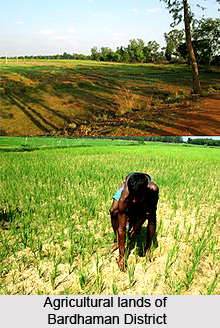
Different types of soil are seen existing within the different topographical and geological conditions within the Bardhaman district. In the west coarse, gritty soil blended with rock fragments is formed from the weathering of pegmatites, quartz veins and conglomeratic sandstones. This soil is reddish in colour, medium to coarse in texture, acidic in reaction, low in nitrogen, calcium, phosphate and other plant nutrients. Towards the east alluvial soil attains an enormous thickness in the low level plains to the east. This alluvial soil is formed of alluvium brought down by the Ajay, Damodar, Bhagirathi and numerous other rivers. These soils are sandy, well drained and slightly acidic in nature.
Bardhaman scores quite well in terms of mineral reverve. The Raniganj coal field found here was the birthplace of the Indian coal industry. Apart from coal, the other important mineral reserves found in the district are iron-ores, calcium carbonate, abrasives, silica bricks and moulding sands, glass sands, building materials, manganese, bauxite, laterite etc.
The forest areas of the district are chiefly situated in the lateritic and red soil high lands in the Aushgram PS of Sadar Subdivision and in the Asansol subdivision. In Ausgram P.S. the forest areas are interspersed with paddy fields. The Durgapur forests are continued in the Birbhum district beyond the Ajay while the forest area in the Asansol subdivision forms a part of the forest area of Dumka District of Jharkhand. Vegetation in the district includes neem, amlaki, coconut, palm, mango, sal, mahua, Arjun etc. Common acquatic and marsh weeds are found in the jheels and swamps in the eastern parts of the district. Animals found in the district include leopard, wolf, hyena, jackal, wild pigs, monkeys, poisonous snakes such as the cobra, karait and the deadly Russel`s viper. Among the birds and fowl found here are pea-fowl, jungle-fowl, jungle crow, house crow, treepie, common babbler, common jora, gold-fronted chloropsis, red-vented babul, red-whiskered bulbul, red spotted bluethroat, brown-backed robin etc. The low-lying swampy areas of Bardhaman being in line of migration provide a very good sheltering place for the migratory birds in winter.


