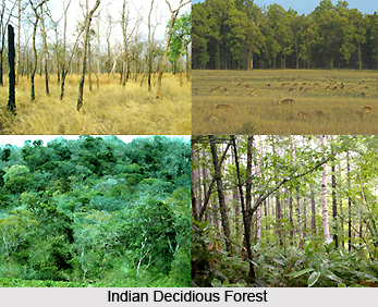
 Forestry in India plays a significant role in preserving the ecological balance and natural eco-systems. Forests are also an economic benefit. They furnish timber and fuel wood. The choicest timber comes from teak forests, distinctive of the monsoon lands. These deciduous forests widen between the Western Ghats in the south and the sub-Himalayan region in the north. Sal is yet another foremost and functional tree, more prevailing in the eastern part of the country. Space for sal trees is comparatively greater than the teak trees.
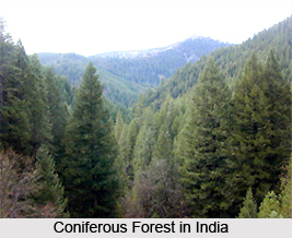
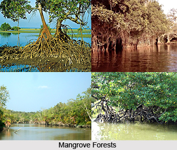
The other trees in more rainy areas comprise bamboos, mahogany and rosewood. They are more widespread in Assam and Kerala. Sundari trees of mangrove category from Sundarbans are used for boat building and manufacture of boxes. The soft wood from coniferous forests of the Himalayas is used for furniture, packing boxes and also as timber in building houses. Pulp is made from soft wood and is in great demand. Regrettably the present time demands the use of forest resources as cautiously as possible and only on a continuing basis, contrasting the present practice of their uncontrolled demolition. Indian forests provide timber, cane, resin, wood pulp, charcoal, firewood and gums, medicinal herbs, fodder and grass. Forestry in India is a major government enterprise in India, which faces the challenges of declining forest cover area due to effects of overpopulation, farming and environmental factors.
During the early 1990s, some 500,000 square kilometers, about 17 percent of India`s land area, were regarded as Forest Area. In 1987, however, actual forest cover was 640,000 square kilometers. However, because more than 50 percent of this land was unproductive or bush land, the area under productive forest was actually less than 350,000 square kilometers, or approximately 10 percent of the country`s land area. The growing population`s high demand for forest possessions continued the destruction and deprivation of forests throughout the 1980s, taking a heavy charge on the soil. An estimated 6 billion tons of topsoil were lost every year. However, India`s 0.6 percent average annual rate of deforestation for agricultural and non-lumbering land uses in the decade beginning in 1981 was one of the lowest in the world.
Many forests during the mid-1990s are found in high-rainfall, high-altitude regions, areas to which access is difficult. About 20 percent of total forestland is in Madhya Pradesh; other states with significant forests are Orissa, Maharashtra, and Andhra Pradesh; Arunachal Pradesh; and Uttar Pradesh. The variety of forest vegetation is large in India; there are almost 600 species of hardwoods, sal (Shorea robusta) and teak being the principal economic species. India`s long-term strategy for forestry development reflects three major objectives. The first being to reduce soil erosion and flooding; secondly, to supply the growing needs of the domestic wood products industries; and finally to supply the needs of the rural population for fuelwood, fodder, small timber, and various forest produce.
 To achieve these objectives, the National Commission on Agriculture in 1976 suggested the reorganization of state forestry departments and advocated the concept of social forestry. The commission itself worked on the first two objectives, emphasizing conventional forestry and wildlife activities; in search of the third objective, the commission recommended the establishment of a new kind of unit to develop community forests. Besides Gujarat and Uttar Pradesh, a number of other states also established community-based forestry agencies that highlighted programs on farm forestry, timber management, extension forestry, reforestation of degraded forests, and use of forests for leisure purposes.
Such socially responsible forestry was encouraged by state community forestry agencies, who strongly emphasized such projects as planting wood lots on uncovered communal cattle-grazing grounds to make villages self-sufficient in fuel wood, to supply timber needed for the creation of village houses, and to provide the wood needed for the repair of farm implements. Both individual farmers and tribal communities were also encouraged to grow trees for their own profit.
The role of forestry in the national economy and in ecology was further stressed in the 1988 National Forest Policy, which alerted on ensuring environmental stability, restoring the ecological balance, and preserving the remaining forests in India. Other objectives of the policy were meeting the need for fuel wood, fodder, and small timber for rural and tribal people while distinguishing the need to actively involve native people in the management of forest resources. Also in 1988, the Forest Conservation Act of 1980 was amended to assist more firm conservation measures. A new target was to increase the forest cover to 33 percent of India`s land area from the then-official estimate of 23 percent. In June 1990, the Central Government took resolutions that combined forest science with social forestry, i.e. taking the socio-cultural traditions of the local people into consideration.
Forest conservation in India has been an avowed goal of government policy since independence. Afforestation increased from a negligible amount in the first plan to nearly 89,000 square kilometers in the seventh plan. Forestry is one arena in which India has actually regretted since independence. Annual fellings at about four times the growth rate are a major cause of deforestation in India. Widespread pilfering by villagers for firewood and fodder also represents a major decrement. In addition, the forested area in India has been shrinking as a result of land cleared for farming, inundations for irrigation and hydroelectric power projects, and construction of new urban areas, industrial plants, roads, power lines, and schools.
 Since the early 1970s, as the researchers realised that deforestation threatened not only the ecology but also their livelihood in a variety of ways, people have become more concerned and involved in conservation. The best-known popular activist movement is the Chipko Movement that is related to forestry in India. In this movement, local women under the leadership of Sunderlal Bahuguna and Chandi Prasad Bhatt decided to fight the government and the vested interests to save trees. The women of Chamoli District, Uttar Pradesh, declared that they would embrace trees if a sporting goods manufacturer attempted to cut down ash trees in their district. Since initial activism in 1973, the movement has spread throughout and has become an ecological movement leading to similar actions in other forest areas. The movement has slowed down the process of deforestation, exposed vested interests, increased ecological awareness, and demonstrated the viability of people power.
In 2006 forestry in India experienced a major change with the passage of the Forest Rights Act, a new legislation that requests to reverse the "historical injustice" to forest dwelling communities that resulted from the breakdown to record their rights over forest land and resources. It also sought to bring in new forms of community conservation.


