 Forest vegetation in east India comprises wet evergreen forests and tropical moist deciduous forests. These two vegetation types constitute the largest chunk of land in these areas. Apart from this, the southern part is also dotted by tropical semi-evergreen, sub-tropical pine and montane wet temperate forest patches. In the wet evergreen forest large tall evergreen trees form the bulk of the main canopy. High humidity, thick mist, hot sun and the soft rocks of the Himalayas encourage luxuriant vegetation. Single giant Dipterocarps and similar trees, or groups of them, project above the general canopy level.
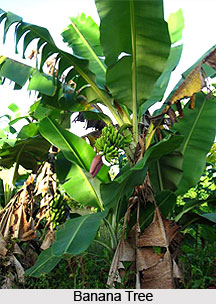
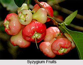
The number of species found in these forests is very great. Deciduous trees are few. The middle and lower canopies are dense, evergreen and varied. Canes and other climbers are abundant as are epiphytes of all sorts. Wild bananas and tree ferns are also found occurring. The ground cover is typically of evergreen shrubs. Herbacious vegetation is scarce. Dipterocarps, Hopea and Shoreas form outstanding big trees. Other associates are trees from Artocarpus, Syzygium, Mesua, Meliacea, and Anacardiaceae. Bamboos are usually present. Wet evergreens are distributed in low outcrops of Patkoi and Naga Hills, high alluvial deposits of the foot hills, north and south banks of Brahmaputra valley, lower hills and hills of Khasi and Jaintia ranges round the Surma Valley mainly on northern and eastern aspects.
Tropical semi-evergreens are dense storied forests 24 metres to 36 metres high. Evergreens predominate particularly in the lower canopy. An appreciable portion is deciduous even if for a very short period of time. Canes usually occur along water courses and climbers are common. Tropical semi-evergreens have developed in moderately heavy to heavy rainfall areas of Assam, Meghalaya, Manipur, Arunachal Pradesh and North Bengal plains. Rainfall is typically about 2000 mm. But it ranges from 1500 mm to 3000 mm. In some parts, like North Bengal plains, it could be as high as 4000 mm. Top storey may include a few Dipterocarps. Syzygium, Cinnamomum, Magnolia and Artocarpus are typical evergreen genera. Common deciduous trees are Terminalia spp., Tetrameles and Stereospermum. Shorea robusta retains a footing with burning or other desiccating factors. The under wood consists of Lauraceae (Phoebe, Machilus, Actinodaphne etc.), Annonaceae (Polyalthia), Meliaceae (Aphanamixis), Mesua etc. Ground flora is poor where the under wood is dense. Evergreen Rubiaceae and monocotyledonous herbs (Alpinia etc) are abundant where the light is adequate.

Sub-tropical pine forests are found in Naga and Khasi hills and in Manipur. They occur between 800 metres to 1600 metres. Rainfall is usually over 1800 mm. Pinus insularis is the prime top canopy species. Other associate are Quercus, Magnolia, Prunus, Rhus. Rubus, Viburnum. Desmodium constitute major genera in ground cover.
Montane wet temperate forests occur in Eastern Himalayas from Darjeeling eastwards on the higher hills of West Bengal, Sikkim, Assam and Arunachal Pradesh. They also occur on the upper levels of Manipur and Naga hills. They are roughly distributed between altitudes 1750 metres to 2750 metres. Rainfall varies between 2000 mm to 3500 mm. Mean minimum temperature for the zone (during winters) is near to freezing point. These are closed evergreen higher forests of trees of larger girth, but medium height, rarely over 25 metres. The crown is usually large and much branched. Crown contains growths of with dripping mosses, ferns, aroids and other epiphytes. Relatively small proportion of crops at higher altitude consists of deciduous species. The forest is essentially mixed ones. But oaks and Lauracea show a strong tendency to predominate. The under wood is typically evergreen. Dwarf bamboo undergrowth develops at higher altitude. This may be very dense and uniform over large areas. Some large woody forms also occur. Major species are Machilus edulis, Michaelia cathcartii, Cinnamomum obtusifolium, Magnolia spp, Engelhardtia spicata, Schima wallichii, Castanopsis spp, Prunus nepalensis, Betula spp, Quercus spp etc. The ground cover consists of Arundinaria maling, Daphne cannabina, Viburnum spp, Plygonum spp, many ferns, Rubus, Strobilanthus etc. Oaks and chestnuts are characteristic of these forests at higher altitudes. Laurels predominate over oaks in lower levels. Magnoliaceae is represented throughout the type. Englehardtia and Schima extend fairly freely up from the lower forests. Rhododendrons also occur freely down from the sub alpine forests above. Acer, Prunus, Alnus are some of the deciduous genera found in the type. Bucklandia, too, is found.


