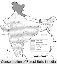
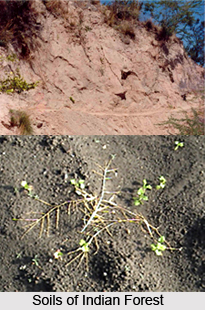
 Forest soils are a natural body having depth and surface area. It exists as a continuous cover on the land surface. Only exceptions are steep slopes. The climate of a place affects the forest soils in many different ways. It has led to the development of a variety of soils in India. Essentially, soil is the product of natural destructive and synthetic forces. The physical and chemical weathering of rocks and minerals forms unconsolidated debris regolith. Its upper part is bio-chemically weathered.
The soils found in the different parts of the country are a function of several factors- climatic, biotic, geomorphic etc. The major soils in Western Zone are dry, sandy and usually unstable. The sand is mounded up by wind in typical dune forms. This happens on the plains of the Indus valley. This also occurs in areas west of Aravalli Mountain Ranges.
In the Northern and Central Zones, the soils seen are recent sandy alluvium to red soils in-situ. Laterite and black cotton soils are met in forests of Madhya Pradesh, Chhatishgarh, Maharashtra and Orissa. Forests in Indo Gangetic Plain have alluvial soils. Forests of Shivalik formations in Sub-Himalayan tracts and foot hills have developed on sandy or clayey soils. These soils are deep and reasonably fertile.
 In the Southern Zone, the soils under forests have originated from a wide range of geological formations and rocks. The soil is almost always shallow and dry. Occasionally it may be of fair depth. This is specially so if the soil is sandy. Black cotton soils dominate in some parts. Hard Lateritic soils are encountered in the eastern parts. Red soil overlay a variety of rocks. Most of them are crystalline. The soils seen in the Western Ghats Mountain Range in India have originated from crystalline rocks, Shales and even Limestones and Quartzites. Alluviums occupy valley bottoms. Soils are highly leached. Base content is low. Silica Sesqui-Oxide ratio is low. The clay is often Kaolinite. Soils are acidic. Mineral nutrients concentrate in surface layers. Leaf fall deposits a large amount of organic matter on the forest floor. This maintains the nutrient status. Nutrient cycling is fast. Removal of forest cover quickly drops soil fertility seriously and permanently.
A number of soils are present in the Eastern Zone. These are red tropical soils, soils developed from tertiary sand stones, Bhabhar deposits, and mature alluvial deposits of river valleys. Many soils have developed from Bengal Gneiss and crystalline and metamorphic rocks. The texture of soils varies. These could be sandy loam, heavy alluvium or clayey soil. They may be yellow or red. Black and richly Humic soils are met in North Bengal.
Thus, discussed are the forests oils found in India and their distribution in the different parts of the country.


