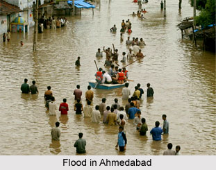
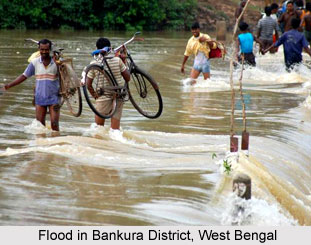
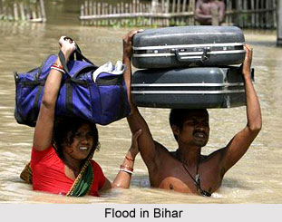
 Floods in India destroy and devastate the lives of the citizens in most of the affected regions. Moreover, many properties and materials are destroyed along with deaths of humans, cattle and other animals. Floods in India are mainly caused due to rainfall in a large area during the monsoon periods. Flood destructions have always brought misery to numerous people, especially in the rural areas. When a large portion of the country remains flooded for a week with few decimeters deep water, it affects the normal life of the people badly. A large number of houses made of mud collapse; it also tarnishes the stored food grains and fodder and devastates the standing crops. Railway tracks and roads are breached at several places. Further more, traffic is suspended for a number of days on certain affected areas. Huge financial losses are incurred by the railways and bus transport companies. Floods badly affect the water supply by damaging the sewage plants. It results in the outbreak of serious epidemics, specifically malaria and cholera. At that time, acute scarcity of water also arises.
 Causes of Floods in India
The areas in the nation which are subjected to serious floods are basically in the plains of northern India. It is also estimated that more than 90% harm of property and crops is caused by the floods in the plains of this region of the country. Lower Tapti and Lower Narmada valleys, the deltas of the Godavari River, the Krishna River and the Mahanadi River are flooded from time to time. It is stated that the major cause of floods is heavy downpour of rain in the catchments areas of rivers and in the poorly drained areas. In plains of few states like Punjab and Haryana, rivers overflow their banks and inundate the adjoining low-level areas. In India, unusual heavy rains occur during the summer-monsoon rainy season. The chances of flood havoc are also high in waterlogged and poorly drained areas. In India, Punjab- Haryana plains are one of the worst flood affected areas and it accounts for more than 15% of the total losses of the country.
Further, in the plain regions of Uttar Pradesh and Bihar, huge areas are inundated where Ganga River receives its tributaries. Near the convergence of river Ganga with its tributaries, free flow of the water is interrupted when Ganga itself is in floods. As a result of the congestion of the water in these tributaries, the water level raises at times causing floods. Owing to such floods, the cultivated lands face total destruction. Huge fertile lands become wastelands after the deposition of course sands. Assam valley is one such fertile belt that has been seriously affected by flood havocs. In Assam, heavy rainfall (more than 200 cm) in the rainy season is the principal reason of floods in Assam Valley. Interestingly, earthquakes that are not very uncommon in this north-eastern state also cause floods in a number of ways. The shift in the level of land also causes the change of the course of the river. Southern part of West Bengal also suffers heavy floods that are caused by poor drainage system and heavy rains. Moreover, floods are a regular feature in the coastal lowlands of Orissa.
Major causes of floods are deforested catchments area of the rivers and secondly, the offshore bars that obstruct the mouths of the rivers, eventually obstructing the free flow of water into the ocean. The deltas of Godavari River and Krishna River have also suffered floods in the country. Comparatively, in the plateau of peninsular India floods are far less destructive. Further, they are far less recurrent than in other parts of the country.

Effects of Floods in India
Floods in India also have a drastic effect on the agricultural sphere. Occasionally water remains standing over large areas for a long span of time hampering the Rabi crop plantation. Destruction of Kharif crop as well as Rabi crop in various places result in dearth conditions that may quite serious similar to that caused by severe droughts. Moreover, roadways and infrastructure is damaged, properties are destroyed along with numerous loss of lives. In the recent years, the most devastating floods in India have occurred in Assam from 1998, in the city of Mumbai in 2005, flood in 2008 which mostly affected title="Maharashtra">Maharashtra, Andhra Pradesh and Bihar; flooding in South India in 2009 and the Leh floods in 2010 in the largest town of Ladakh. Several people lost their lives in the 2010 Leh floods which occurred as a result of cloudburst and heavy rainfall which triggered flash floods and mudslides.
Government of India spends a huge some of money on relief and rehabilitation for the people every year. Several flood control measures have been taken in the country such as construction of storage dams, making of proper drainage channels etc.


