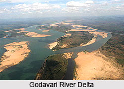
 India supports about 10% of the world`s Biological Diversity, with just 2% of the worlds land area, thus making it the seventh richest bio-diversity country in the world. This difference bestows a great responsibility on the government with the responsibility to protect and conserve the rich floral, faunal & ecological diversity of Godavari river basin. The protection is well carried out by constructing a network of sanctuaries and national parks, which cover areas of ecological and biological importance. The State of Andhra Pradesh is located strategically and its geographical variation is thought to be as one of the rich bio-diversity states in India.
In the terms of ecological significance, a survey declared Andhra Pradesh to be the fifth largest state in India adhering to the factor of ecological importance. Moreover, this state has the longest coastline that stretches over 1000 Kms. The state has two mighty river systems of Krishna and Godavari. The state has wide and different vegetation types enriched by a diversity of flora and fauna. Andhra Pradesh is located strategically in the central region of the Indian sub-continent and thus has representatives of the magnificent Indian plant and animal life. Its varied countryside ranges from the hills of Eastern Ghats and Nallamallas to the shoreline of Bay of Bengal and thus supports speckled ecotypes, which again supports a rich diversity of flora and fauna. The forest in the state can largely be divided into four major biotic provinces.
The ecological effect of the Godavari River in various regions is as follows
Deccan Plateau - 53 %
Eastern Highland - 11 %
Central Plateau - 35 %
East Coastal Plains - 1 %
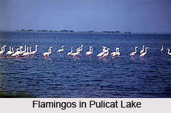
 The vegetation found in the state is largely made of dry deciduous style with a mixture of precious trees like Teak, Dalbergias, Pterocarpus, Terminalias, Anogeissus and so on. The hills of Eastern Ghats add highly to the biological diversity and provide centers of endemism for plants, birds and lower forms of animal life. The varied environment harbors a assortment of fauna, including tiger, panther, sambar, wolf, cheetal, wild dog, chowsingha, black buck, hyena, sloth bear, nilgai, gaur, chinkara and a number of birds and reptiles. The long sea coast offers the inhabiting place for sea turtles, the back water of Pulicat lake are the feeding and breeding grounds for flamingo and grey pelican, the estuaries of river Godavari and Krishna initiates the growth of rich mangrove forests with fishing cat and otters as key stone species.
The Godavari river basin also possesses of some exceptional and endemic plants like Cycas beddomei, Terminalia pallida, Syzygium alternifolium, Pterocarpus santalinus, Shorea talura, Psilotum nudam, Shorea tumburgia and so on. Similarly the double banded or the jerdon`s courser, the slender loris, the golden gecko are rare and dying out inhabiting the basin.
Andhra Pradesh has a total network of 22 Sanctuaries and 4 National Parks encompassing an area of 12,579.205 Sq. Kms. or 4.57 % of the geographical area of the entire basin. The states lying in this basin are rich in forests and diverse flora and fauna thus providing ample capacity for promoting eco-tourism. The natural beauty of the state has not been exposed to the visitors till now. The government has taken up the plan to open up the Protected Area Network of the State for all the visitors. Each of the Wildlife Sanctuary and National Park of the state has its own significance and has something unique for the visitors.


