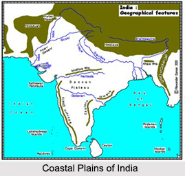
 The wide stretch of landmass of India, lying between the Eastern Ghats and the Bay of Bengal are the Eastern Coastal Plains. It stretches from Tamil Nadu in the south to West Bengal in the north. The Eastern Coastal Plains are broad and its width is 100 km to 120 km. The Mahanadi River, Godavari River, Kaveri River and Krishna River traverse these plains. These rivers have carved out broad valleys and deltas. The region receives both the northeast and southwest monsoon rains. North of the Godavari Delta where the Eastern Ghats close on the sea, the coastal lowland is narrow. At some places, it is less than 32 km. The annual rainfall ranges between 1,000mm and 3000 mm.
Regions of the Eastern Coastal Plains
The Eastern Coastal Plains are divided into seven regions. The Mahanadi delta in Odisha; the southern Andhra Pradesh plain; the Krishna Godavari deltas in Andhra Pradesh; the Kanyakumari coast; Coromandel or Madras Coast in Tamil Nadu and sandy littoral. As the Indian Peninsular Plateau, south of the Satpura Range is tilted to the east, all rivers of Deccan with the exception of the Tapti River, flow eastwards towards the Bay of Bengal. These rivers have spread alluvium over almost whole of this plain and have built large deltas at some places. Sea waves being far less furious than those impinging on the west coast, have failed to scour away huge amount of sediments brought by large rivers like the Mahanadi, Krishna, Kaveri and Godavari. Thus, these rivers have built large deltas which being fertile and irrigated are heavily populated. Spits, lagoons and off-shore bars also develop along the coast. The coast is fringed at some places with dunes. Mangrove forests also grow along the seaward front of the deltas. Because of the shallowness of the sea near the emerged Coastal lowlands, deep natural harbours except Vishakapatnam, Paradip and Tutikorin are absent along the coast.
Sub Regions of the Eastern Coastal Plains
There are important sub regions of the Eastern coastal plains. They are discussed as follows:
•Coromandel Coast: This coast is named after the ancient royal dynasty of the Cholas who ruled Tamil Nadu. It happens to be a wide region which covers almost an area of 8800 square meters towards Eastern part of Tamil Nadu sharing its borders with the Bay of Bengal, Utkal Plains, Eastern Ghats and Kaveri Delta. It is one straight coastline which comprises of several temples. It is also known as the “land of temples†for the same reason. It does not have any sort of dense forests and the soil found here is marshy. Alongside the coastline, coconut palms are found standing tall. The agriculture of this region holds the entire responsibility of economy. The crops of rice, legumes, sugarcane, cotton and groundnuts are cultivated here that serve as a major income source for the farmers. Apart from that, there are also various large scale industries which manufacture fertilizers, chemicals, amplifiers and automobiles. There are interlinking train lines and roads running parallel to the coast line. They are known to link major cities like Chennai with Chengalpattu, Cuddalore and Puducherry.
•Kanyakumari Coast: This coast line extends over southern parts of the Indian coastline.
•Krishna Delta: It is situated in the south-east regions of Vijaywada.
•Godavari Delta: It is of about 150 kms length. The political structure of this delta is as same as the Mahanadi River.
•Mahanadi Delta: It is situated in the Eastern coastline and comprises of the fertile alluvial soil.
•Coastal Andhra Plain: It is located in Andhra Pradesh. The area is very fertile because of the soil deposits of the Godavari and Krishna Rivers.


