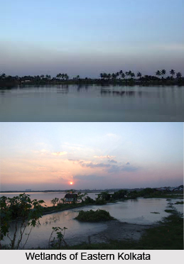
 The wetlands of East Calcutta Wetlands or the East Kolkata Wetlands are famous all over the world for their multiple uses and were designated as "wetland of international importance" under the Ramsar Convention on August 19, 2002. The wetlands are partly natural and largely human made lying east of the city of Calcutta. The wetlands cover 125 sq. km. covered with salt marshes and salt meadows as well as sewage farms and settling ponds, oxidation basins and intertidal marshes.
The wetlands are used to treat Kolkata`s sewage and the nutrients contained in the wastewater maintain fish farms and agriculture. The local people of the area developed the resource recovery systems using the wastewater from the city and this is the largest project in the world. With this it has saved the city of Kolkata from constructing and maintaining a wastewater treatment plant. It is also the only metropolitan city in the world where the State Governments has introduced development controls to conserve the water bodies.
East Calcutta Wetlands is an unrivaled instance of good use of city sewage for the purpose of fishery and agriculture. It is a matchless combination of environmental protection and development management. It is also the largest collection of sewage fed fishponds in the world in one place.
There are about hundred species of flora in and around East Calcutta Wetlands. They include Sagittaria montividensis, Cryptocoryne ciliata, Cyperus spp., Acrostichum aureum, Ipomoea aquatica, etc. It is also the habitat of several mammals like the marsh mongoose, small Indian mongoose, palm civet and the small Indian civet. Endangered species like the Indian mud turtle have also been found in the wetlands. Certain species of birds also visit the wetland. Prominent ones are grebe, coot, darter, shag, cormorant, teals, egrets, jacanas, snipes, tern, eagle, sand piper, gulls, rails and kingfishers.
The East Kolkata Wetlands with its garbage farms and fishponds have provided the city with three facilities, that of, food, sanitation and livelihood. It also provides ecological security to the city of Kolkata.
Over the past few years this functional wetland has come under severe threat. With the population explosion some of the largest fish farms have been converted from pisiculture to paddy cultivation. Industries also empty their wastewater effluent without treatment to the channels flowing eastwards and these ultimately land up in the wetlands. This has caused substantial amount of deposits of metal in the canal sludge and made the wastewater incapable for the consumption for the fishes and the plants grown in the wetland.
However by the verdict of the Calcutta High Court in 1992, the wetland area is protected and prohibits any change in land use. Filling up of water bodies in this area is not permissible under West Bengal Town and Country (Planning and Development) Act, 1979 as well as under the West Bengal Inland Fisheries Act, 1984 (with amendment in 1993).


