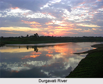
 Durgavati River in Bihar is a tributary of Karmanasa River, which is known as the "river full of evil works". It flows through the Kaimur district and it is one of the major lifeline of this district in Bihar. Durgavati River, also known as Durgabati River or Durgawati River originates at about seven miles east of the mother river Karmanasa River.
In the upper course of Durgavati River or Durgabati River or the Durgawati River, it reaches in a rocky channel of 20 to 30 feet wide. It runs nearly north for about nine miles when it plunges down the rocky boundary of the tableland in to the head of deep glen named "Kadhar Kho".
There three other fast-moving waters join the Durgavati River that like it rise on the tableland of the Turkan Kharawars and fall down the rocks at the head of the same glen. These three rivers are the Lohara River, Hatiyadub River and Kothas River. Durgavati Falls, with a length of 80 meters on the Durgavati River is at the edge of the Rohtas Plateau. This waterfall adds the beauty and attracts the tourists to come for nature tourism.
This article is a stub. You can enrich by adding more information to it. Send your Write Up to content@indianetzone.com


