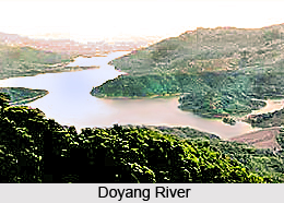
 Doyang River is one among the four rivulets of the Dhansiri River that is situated in Kohima District of Nagaland. Doyang River thrives to be one of the most important rivers in the district as it is one of the biggest and longest river which runs near the southern boundary of Nagaland which flows through the Wokha district about 21 kilometers from the town. The river has many tributaries with Tsui, Tullo and Tishi being the largest of all which merge with the Doyang River. The Angami tribe in whose area it rises calls it Dzu or Dzulu. Doyang Hydroelectric Power Project India is located at Wokha District, Nagaland.
Course of Doyang River
It originates in the north of the district before turning eastwards and finally meeting the Saju River. This river enters into Zunheboto district from Wokha before going further downstream and falling into Dhansiri river of Assam valley. It later on forms a boundary line between Sema and Lotha areas. In the west of Litami it makes westward bend and merged with the western Lotha area in Wokha district, and proceeds to the southern border of the district,
 it suddenly turns westward and then debouches the hills for the plains west of Koro village and then finally falls into the Dhansiri river of Assam valleys. Many small hill streams from other districts have fallen into Doyang and towards its central and western parts giving it a charming look.
Tributaries of Doyang River
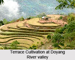
The major tributaries of the river are Tsui, Tishi and Tullo. Two other significant rivers, Chubi and Nzhu are also the tributaries of Doyang River. Tsui is the combined water of Keleki and Tangki streams; whereas the Tishi joins it in the Sema area. Doyang is not only important river for Wokha district alone but it is also equally an important river of Nagaland. In the valley along the Doyang River the modern system of cultivation like terrace is being carried out successfully, especially in two particular areas near Pangti village called "Pofu hayi" and "Tentsu hay".
Vegetation at Doyang River Valley
The river is one of the major sources of water for people in different parts of the district. Besides vegetables and fruits such as banana, pineapple,
 papaya etc is abundantly and luxuriantly grown in those two areas owing to the fact that the place is fertile and rich in alluvium. The river valley has some impressive and striking surroundings which are ideal for nature lovers. Tourists can also visit the nearby Pangti village, where the modern system of cultivation like terrace is being implemented.
Doyang Dam
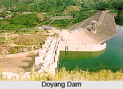
The Doyang Dam is build across the Doyang River near the Wokha village in Nagaland. It is a rock-fill dam with a height of 92m. The big dam is visible from most of the hill tops of area and has become the best place for water sports in the state. Doyang Reservoir is user for power generation, fisheries and also provides shelter to flora and fauna around.


