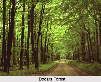
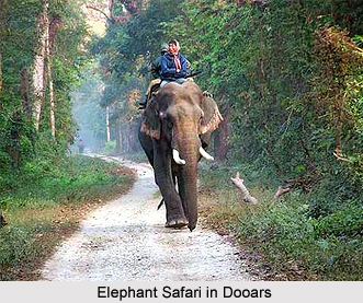
 Dooars is the address of enchanting form of urban madness where nature has invited the tiresome soul to the backwoods of enchantment. Having its etymological roots deep embedded in the term "doors"- (doors to Bhutan) the region is located in the district of Jalpaiguri as Cooch Behar gives way to the hill stations of North Bengal. Dense natural forests intertwined with lush green tea gardens where dusk settles briskly inconspicuously as the twilight downpours through the outlying, far flung slopes of mountain vegetation. This piece of god`s own land is, however, easily accessible. Inhabited meagrely by hospitable tribal clan, it draws tourists for its lush green tea gardens and golden sunset over the east`s unarguably most enchanting landscape, rich in biodiversity and deep forests. The weather in the region is delightfully pleasant even on warm days.
Location of Dooars
Dooars valley stretching from river Teesta on the west to river Sankosh on the east, over a span of 130 km by 40 km includes itself as a major part of Jalpaiguri district. To its north stands the east Himalayas a nature borne backdrop indeed. Vast land of dense, evergreen forests teeming with abundant wildlife, expanding tea gardens, deep cascading, rippling rivers, interspersed with sleepy or busy settlements, is what Dooars is all about.
Grand sojourn through the rolling hill slopes, widespread lush green tea gardens separated by meandering silvery mountain streams, high Sal forests, small quiet ethnic villages, vast meadows with a blue out line of the great Himalayan ranges in the horizon, endless sky.
Lying in the Himalayan foothills, Dooars has great natural beauty. Wildlife which is rich in tropical forests and innumerable hill streams cutting across the green carpet of tea gardens and undulating plains, low hills rising up from the rivers. A drive through the Dooars plains, the gateway of Bhutan and the entire North East of India, can be the experience of a lifetime.
History of Dooars
 Dooars with all her enigma and mysticism whispers the paraphernalia of her history which is as old as the distant hills. The current historical research carried out by Sailen Debnath, an eminent scholar of the region conforms that Dooars was the seat of the medieval Kamata kingdom which emerged as a sovereign state from the middle of the seventh century. Most probably, Nalrajar Garh in Chilapata Forest was the earliest capital of Kamatapur, and subsequently through various ups and downs the capital was shifted to Mainaguri and then to Prithu Rajar Garh before its final shifting to Gosanimari, an ancient port-town since the seventh century. After the kingdom of Kamatapur as was devastated by Alauddin Husain Shah of Gaur in 1498, there emerged the Koch kingdom again in the Dooars under the leadership of Vishwa Singha. Hingulavas near Mahakalguri in the Dooars was the earliest capital of the Koch kingdom. It was long after that the Koch capital was shifted to Atharakota and then ultimately to present Cooch Behar town.
Taking advantage of the weakness of the Koch kingdom in subsequent times, Bhutan took possession of the Dooars. This region was controlled by the kingdom of Bhutan when the British annexed it in 1865 after the Bhutan War under the command of Captain Hedayat Ali. The area was divided into two parts: the eastern part was merged with Goalpara district in Assam and the western part was turned into a new district named Western Dooars. Again in the year 1869, the name was changed to Jalpaiguri District. After the end of the British rule in India in 1947, the Dooars acceded into the dominion of India and it merged with the Union of India shortly afterwards in 1949.
The average rainfall of the area is about 3,500 mm. Monsoon generally starts from the middle of May and continues till the end of September. Winters are cold with foggy mornings and nights. Summer is mild and constitutes a very short period of the year. The climate of Dooars plains in Jalpaiguri district is more or less similar to that of the remaining districts of North Bengal. But owing to its proximity to the hills, it has a longer winter and heavier rainfall.


