 Districts of Upper Assam Division include Lakhimpur District, Dibrugarh District, Tinsukia district, Sivasagar district, Jorhat District, Golaghat district, Charaideo district and Majuli.
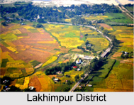
Lakhimpur District
Lakhimpur District is an administrative district in the state of Assam. The district headquarters are located at North Lakhimpur. Lakhimpur District is bounded on the north by Siang District and Papumpare District of Arunachal Pradesh and on the east by Dhemaji District and Subansiri River. Majuli Sub Division of Jorhat District stands on the southern side and Gahpur sub division of Sonitpur District is on the West.
Dibrugarh District
Dibrugarh District is an administrative district in the state of Assam in India. The district headquarters are located at Dibrugarh city. The district occupies an area of 3381 square km.
Dhemaji District
Dhemaji district is an administrative district in the state of Assam in India. The district headquarters are located at Dhemaji. Dhemaji district occupies an area of 3237 square km and has a population of 571,944. The main religions are Hindus 548,780, Muslims 10,533, and Christians 6,390.
Tinsukia District
Tinsukia district is one of the 27 administrative districts in the state of Assam, India. The district headquarters are located at Tinsukia. Tinsukia district occupies an area of 3,790 square kilometers.
Sivasagar District
 Sivasagar district formerly known as Sibsagar is one of the 32 districts of Assam. Sivasagar town is the administrative headquarters of this district. This historic place is also known for its rich and diverse biodiversity. Sivasagar district covers an area of 2668 square kilometers as against total area of 78438 square kilometers of Assam as per census of 2001.
Jorhat District
Jorhat District is an administrative district of Assam. It is located in the central part of Brahmaputra River Valley. Jorhat District is bounded by Lakhimpur district on north, Nagaland state on the south, Sivasagar on the east and Golaghat on the west. On the North of the district, the river Brahmaputra forms the largest riverine island of the world- Majuli. The administrative seat is located at Jorhat town.
Golaghat District
Golaghat district is an administrative district in the state of Assam in India. It attained district status in 1987. The district headquarters are located at Golaghat. The district occupies an area of 3502 square km and lies 100 m above sea level.
Charaideo District
Charaideo district is an administrative district in the state of Assam in India.
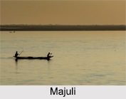
Majuli Island
Majuli is the biggest river island in the world. It is located on the Brahmaputra River, Assam. It is also the first island district of the country. The island had a total area of 1,250 square kilometers at the beginning of the 20th century, but having lost significantly to erosion it had an area of only 352 square kilometers in 2014. Therefore, this tourism destination lost the position of district in Assam.


