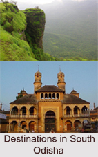
 Districts of Southern part of Odisha include the districts like Malkangiri district, Koraput District, Rayagada District and Gajapati District.
Malkangiri District
Malkangiri district is a district of the state of Odisha.
Koraput District
Koraput District is a district of Odisha and known for rich and diverse types of mineral deposits. It is located along the Eastern Ghats Mountain Range in India.
Rayagada District
Rayagada District is a mineral-rich district in the southern part of the state of Odisha. The city Rayagada is its headquarters. Rayagada district got the status of a separate district with effect from 2nd October 1992. The population of this district consists mainly of tribals. The Kondhas or Kondhs form the majority of population followed by Souras. Apart from Odia, several adivasi languages like Kui, Kondha, Soura are spoken by the indigenous population of the district. Rayagada District occupies a total area of 7,584.7 square kilometers. Rayagada District is divided into eleven blocks. The district generates income mainly through agriculture based activities. Paddy, wheat, ragi, green gram, black gram, groundnut, sweet potato and maize are the major crops grown in the area.
Gajapati District
Gajapati District is a district of Odisha. It was created from Ganjam District in October, 1992. Gajapati district was named after Maharaja Sri Krushna Chandra Gajapati Narayan Dev, the Raja Sahib of the Paralakhemundi estate (the first Chief Minister of the state), who is remembered for his contribution in the formation of a separate state, and inclusion of the Paralakhemundi estate in Odisha. Gajapati District headquarters at Paralakhemundi, formerly a princely estate, has been clustered within a radius of approximately 5 kilometers around the geometric centre of Paralakhemundi. Gajapati District is a part of the Red Corridor Area.
This article is a stub. You can enrich by adding more information to it. Send your Write Up to content@indianetzone.com


