 Districts of Shantal Parganas Divisions constitute one of the five administrative units known as the divisions of Jharkhand. Some of the districts in Shantal Divisions are Godda district, Deoghar district, Dumka district, Jamtara district, Sahibganj district and Pakur District
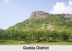
Godda District
Godda district is one of the twenty-four districts of Jharkhand state in eastern India. It lies in the northeastern part of the state. The geographical area that now comprises Godda district used to be part of the erstwhile Santhal Parganas district. Godda town is the headquarters of Godda district. Godda district is 2110 km.sq., with a population of around 861,000. The district is without any rail link, the nearest railway station being Barahat. The main economic activity of the people is agriculture, and major crops are paddy, wheat and maize. Godda is the land of a tribe called Santhals. Godda is not only a land of tribes; the local inhabitants also include the non-tribal and urban people.
Deoghar District
Deoghar district is one of the twenty-four districts of Jharkhand state in eastern India, and Deoghar town is the administrative headquarters of this district. This district is known for the Baidyanath Jyotirlinga shrine. This district is part of Santhal Pargana division.
Dumka District
Dumka District is one of the twenty-four districts of Jharkhand state in eastern India, and Dumka is the administrative headquarters of this district.
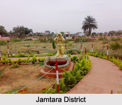
Jamtara District
Jamtara district is one of the twenty-four districts of Jharkhand state in eastern India. Jamtara town is the administrative headquarters of this district. The district is situated between 23 degree 10 minutes and 24 degree 05 minutes north latitudes and 86 degree 30 minutes and 87 degree 15 minutes east longitudes.
Sahibganj District
Sahibganj district is one of the twenty-four districts of Jharkhand and Sahibganj is the administrative headquarters of this district.
Pakur District
Pakur district is one of the twenty-four districts of Jharkhand and Pakur is the administrative headquarters of this district. The district, with a population of 899,200, and covering an area of 686.21 square km, is situated on the north-eastern corner of Jharkhand state. The district is bounded on the north by Sahebganj district, on the south by Dumka district, on the west by Godda district, and on the east by the Murshidabad district of West Bengal. Pakur is famous for black stone. It has six blocks and a nagar panchayat.


