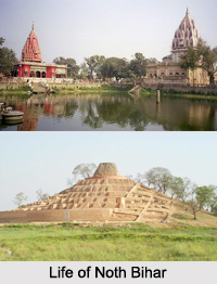
 Districts of North Bihar include the Trihut Division and Darbhanga Division. Here some of the districts are East Champaran District, Araria district, Kishanganj district, Madhubani District, Sheohar District, Sitamarhi District, Supaul district and West Champaran District.
East Champaran District
East Champaran District is an administrative district in the state of Bihar. The district headquarters are located at Motihari. The district occupies an area of 3969 km2 and has a population of 3,933,636 (as of 2001). East Champaran is a part of Tirhut Division. It is currently a part of the Red Corridor. East Champaran District is the second most populous district of Bihar after Patna.
Araria District
Araria District is one of the thirty-eight districts of Bihar state, India, and Araria town is the administrative headquarters of this district. Araria district is a part of Purnia division. The district occupies an area of 2830 km². It has a view of Mount Kangchenjunga of Himalayan Mountain Range.
Kishanganj District
Kishanganj district is one of the thirty-eight districts of Bihar, and Kishanganj town is the administrative headquarters of this district. Kishanganj district is a part of Purnia division.
Madhubani District
Madhubani District is one of the thirty-eight districts of Bihar state, and Madhubani town is the administrative headquarters of this district. Madhubani district is a part of Darbhanga Division. The district occupies an area of 3,501 square km and has a population of 3,570,651.
Sheohar District
Sheohar District is an administrative district in the state of Bihar. The district headquarters are located at Sheohar, and the district is a part of Tirhut Division. This district was carved out of Sitamarhi district in 1994. Sheohar District occupies an area of 443 km. sq and has a population of 656,916. Sheohar District is known for its greenery and clean environment. Cadamba and Teak are the principle trees of this district. Nilgai or blue bull is the regional animal of this area. Sheohar District has mixed population of Hindus and Muslims. Agriculture is the main economy in Sheohar District. It is one of the most flood-affected districts in Bihar.
Sitamarhi District
Sitamarhi is one of the districts of the state of Bihar. Sitamarhi town is the administrative headquarters of this district. The district is a part of the Tirhut Division and is located along the border of Nepal.
Supaul District
Supaul district is one of the thirty-eight districts of Bihar and Supaul town is the administrative headquarters of this district. This district occupies an area of 2,410 square kilometers. The district was carved out from the erstwhile Saharsa district on 14th March 1991.
West Champaran District
West Champaran District is an administrative district in the state of Bihar. It is a part of Tirhut Division. The district headquarters are located in Bettiah. West Champaran District is known for its fluid border with Nepal. West Champaran District is located just 60 km (37 mi) west of Birgunj in Nepal, where people can shop for Chinese, Korean and Japanese goods.


