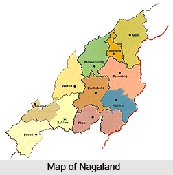
 Nagaland has 11 administrative districts. Nagaland is a vibrant hill state located in the extreme North Eastern end of the country. This state is bounded by Myanmar in the east; by Assam in the west; by Arunachal Pradesh and a part of Assam in the north with Manipur in the south. Districts of Nagaland are headed by district magistrates or deputy commissioners. Each district is under the administration of a deputy commissioner and he is assisted by other officials, who are in charge of the different wings of the district administration. Maintenance of law and order in a particular district of Nagaland is the responsibility of Superintendent of Police.
There are 11 districts in Nagaland and these are mentioned below -
* Dimapur District
* Kephire District
* Kohima District
* Longleng District
* Mokokchung District
* Mon District
* Peren District
* Phek District
* Tuensang District
* Wokha District
* ZunZunheboto District
Dimapur District: Dimapur District is an administrative district of Nagaland with its headquarters at Dimapur. Major portion of this district is plain land. Dimapur District comprises heterogeneous population. However, majority of the population includes Naga tribe.

Kephire District: Kephire District is a newly created district of Nagaland. This district is the ninth administrative district of Nagaland and it was formed by carving out Tuensang District. This district has its headquarters at Kephire. Seyochung, Sitimi, Pungro and Kiphire are the major cities of this district.
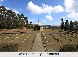
Kohima District: Kohima District is one of the eleven administrative districts of Nagaland. This district is situated in the southern region of the state at an elevation of 1444 metres above the sea level.
Longleng District: Longleng District is the newly created tenth district of Nagaland. This district was carved out of Tuensang District. It has its headquarters at Longleng. Major towns of Longleng District are Tamlu and Longleng.
Mokokchung District: Mokokchung District, an administrative district of Nagaland, and has its headquarters at Mokokchung. This district is mainly inhabited by Naga tribe.
Mon District: Mon District is one of the eleven administrative districts of Nagaland. This district is located in the northernmost part of Nagaland. Mon town is the district headquarters.
Peren District: Peren District is one of the newly created districts of Nagaland. This district was formed by dividing Kohima District. It has its headquarters at Peren. Major towns of Peren District are Tening, Jalukie and Peren.
Phek District: Phek District is located in the south-eastern part of Nagaland. Initially, this district was a part of Kohima District. This district came into existence in the year 1973. Phek District is mainly inhabited by the Chakhesangs and Pochurys.
Tuensang District: Tuensang District is the largest administrative district of Nagaland. It is located in the eastern part of the state. Mon, Longleng and Kephire districts were formed by carving out carving out Tuensang District. Tuensang is the administrative headquarters of this district.
Wokha District: Wokha District is an administrative district of Nagaland. Wokha is the district headquarters of this district.
Zunheboto District: Zunheboto District is one of the 11 administrative districts of Nagaland. Zunheboto is the district administrative headquarters. This district is mainly inhabited by the Sumi Nagas, the warrior tribe of the state.


