 Districts of Jammu and Kashmir constitute sixteen districts which are the administrative units of the state. The districts of the state have been further subdivided into blocks and `tehsils` that initiate the government in the administration of the district. The districts of Jammu and Kashmir encompass fifty four towns, three municipalities, two hundred and eighty one uninhabited villages and the six thousand four hundred and seventy seven inhabited villages.
Anantnag District
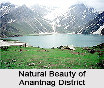
Anantnag district of Jammu and Kashmir covers an area of 3934 square kilometers. It is situated 55 kilometers to the south east of the district of Srinagar. With an enormous area of productive land, the district is also known as the `Granary of the Kashmir Valley`. Baramula District is the largest District in the state both with reference to the population and area. The District is spread over an area of 4588 Sq.Kms. The district is bounded by Kupwara in the North, parts of Srinagar and Ladakh in the East, Budgam and Poonch in the South, and has the line of control in west. The construction of Hindu Teertha and Buddhist Vihars made the place sacred to Hindus as well as Buddhists. 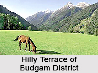
Budgam District
Budgam district came into being in 1979, prior to which it was division of Srinagar district. It is bordered by Baramula and Srinagar in north, Pulwama in south and Poonch in south west. Budgam district offers many spectacular locales and has great tourism prospective that has largely remained intact so far. Bandipore district is a new District in the state of Jammu and Kashmir. It is bounded on the west by Kupwara district on the south by Ganderbal and Baramula District, on the east by Kargil district and on the north by Neelum District. It is located on the banks of the river Wular which is the largest fresh water lake in the whole of Asia. Doda acquired the status of a district when it was carved out of the previous district of Udhampur in the year 1948. The total geographical area of district Doda is approximately 4500 Sq. kms. Doda District is gifted with vast wealth of natural splendour and is expansively rich in forests.
 Jammu District
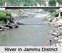
Jammu district derives its name from the city of Jammu. The district is the winter capital of the state of Jammu and Kashmir. Covering an area of 3097 square kilometers, the district is one of the most inhabited districts of the state. The rocky district of Kargil was created out of the district of Ladakh in the year 1979. The district is situated in the heart of the Kashmir Valley at a distance of 205 kilometers from Srinagar. Kathua district is located in the south eastern end of the state of Jammu and Kashmir. The total area of the place is 2651 square kilometers. Kupwara district is the backward frontier District of Kashmir Valley, full of picturesque beauty. Dense forests and rich wild life make it noteworthy from tourism and wildlife point of view. The geographical area of the District is 2379 sq kms. Poonch District is popularly known as mini Kashmir of the state and is the smallest in area and the remotest district of Jammu and Kashmir. This district witnesses an amalgamation of people of different faiths, caste and creed who are living peacefully in the district.
Leh District
 Leh with an area of 45110 Sq Km makes it largest district in the country in terms of area. Leh district comprises Leh town and 112 inhabited villages and one un-inhabited village. This district is a popular tourist destination with many historical buildings and monasteries. The Pulwama District has a congenial climate, innumerable springs, streams, water falls, fragrant flowers and other natural sceneries. The district is centrally located in the valley of Kashmir and is a popular place for Adventure Tourists because of its clean water streams, lakes, magnificent trees and mighty mountains. Srinagar district is situated in the centre of Kashmir Valley. In the north it is flanked by Kargil and Ganderbal in the South by Pulwama, and in the north-west by Budgam. The district is spread over an area of 294 Sq. Kms.
Rajouri District
The Rajouri District drives its name from Rajouri town. Rajouri District has an area of 2630 Sq. Kms. and is situated in the west of Jammu Division. It is surrounded by the Poonch, Udhampur and Jammu Districts. Places worth seeing near Rajouri town are Rajouri fort, Gurudwara Chhati, Padshahi, Balidan Bhavan, Rama Temple, Jama Masjid and Shiv Mandir. Udhampur district has its headquarters in the city of Udhampur. It is one of the largest districts of the state. The district is subdivided into 5 tehsils and 12 community blocks. Samba district is an agriculture-based place of Jammu and Kashmir. Tourists from all over the globe come to visit Samba in different intervals of time. The culture of Samba speaks of the ancient legacy and lifestyle of the inhabitants of that place. Samba represents a rich tradition of local arts within its geographical premises.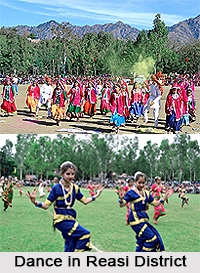
Kathua District
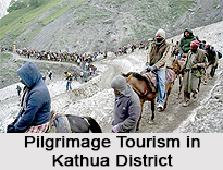
Kathua district is amongst the 22 administrative districts which include Jammu and Kashmir under the rule of India. It is surrounded by Udhampur and Doda districts on its northern side, Jammu on its western side, Himachal Pradesh to the eastern end, Pakistan`s border towards its western side and Punjab on its south. This region is of mythological importance since legend states that Lord Krishna had arrived here to retrieve the `Koh-i-Noor` diamond from Jamabant.
Samba District
This is a newly formed district in Jammu and Kashmir. Prior to the formation of Samba, this very area was administered as a portion of the Jammu district. There are 22 local towns in Samba district and four major blocks known as Ghagwal, Vijaypur, Samba and Purmandal. Rajpura is considered the biggest district in this Indian state. Every block comprises numerous GREF panchayats.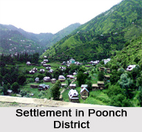
Reasi District
One of the most ancient towns of Jammu and Kashmir and was the region which consisted of the erstwhile state of Bhimgarh which was set up by Raja Bhim Dev in the 8th century. Reasi remained a district of the province of Jammu till 1948. However, in 1948, a large chunk of the area which includes the district of Reasi was joined with Udhampur district. Some interesting tourist spots located here are the Vaishnodevi Temple, Bhimgarh Fort, Kalika Temple, the shrine of Shivkhori and others.
Udhampur District
The town of Udhampur is the official headquarters of the district of Udhampur. Udhampur is divided into seven tehsils like Katra, Gool, Ramnagar Tehsil, Chenani, Gulabgarh, Udhampur and Majalta. The seven blocks of Udhampur involve Udhampur, Dudu Basantgarh, Panchari, Gordi, Chenani, Ramnagar and Majalta. The cave of Vaishno Devi, Patnitop, Ramnagar Chowk, Jakahni Park, Devika Ghats, Salain Talab, Gole Market, Main Bazar, Sheesh Mahal in Ramnagar, Latti and numerous other tourist destinations are present in this district.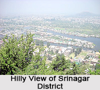
Ramban District
Ramban is a district which is newly formed. It is located on the northern side of Udhampur district. It is surrounded by Patnitop on its south, Banihal on its north, Gool on its western side and Assar on its eastern side. There are two tehsils in this district, namely Banihal and Ramban and four different community blocks which are referred to as Ramsoo, Banihal, Gool and Ramban.
Srinagar District
Srinagar is located at the centre of the valley of Kashmir and is known for its maximum population. This district is the summer capital of the state of Jammu and Kashmir. The spectacular Dal Lake is present in the Srinagar district and forms an important tourist locale. It is divided into two tehsils which are Srinagar North Tehsil and Srinagar South Tehsil. The Shankaracharya Temple, Kheer Bhawani Temple, Hazratbal Shrine, Zestha Devi Temple, Shah-i-Hamadan Temple and many other temples and shrines complete the numerable tourism spots.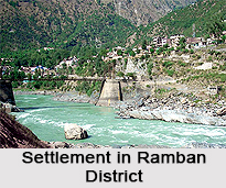
Poonch District
Also known as `Punch`, Poonch district is a very remote district of this state. The Line of Control surrounds Poonch on the southern, western and northern side. During the time of the war of Indian independence from the British Raj, Poonch was divided into two parts, one of which belongs to present-day Pakistan and the other portion of which is a part of India. Four tehsils of Poonch include Surankote Tehsil, Mandi Tehsil, Haveli Tehsil and Mendhar Tehsil. Further subdivision of these districts is blocks named as Balakote, Mandi, Poonch, Buffliaz, Meendhar and Surankote.
Jammu and Kashmir also involves many other districts like Doda, Kishtwar, Kulgam, Baramulla, Bandipora, Shopian, Kupwara, Pulwama, Ganderbal and Kargil.


