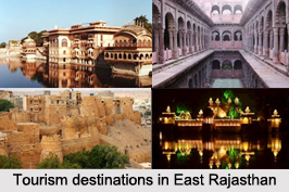
 Districts of Eastern part of Rajasthan had many Princely States that was formed during the rule of British era. Now these are the popular tourism attractions here. Some of the districts in east Rajasthan are Bharatpur District, Dholpur District, Karauli District, Sawai Madhopur District, Baran district, Kota District and Jhalwar District.
Bharatpur District
Bharatpur District is a district of Rajasthan state. The town of Bharatpur is the district headquarters. Bharatpur District is a part of National Capital Region (NCR).
Dholpur District
Dholpur District is a district of Rajasthan state in Northern India. The town of Dholpur is the district headquarters. Dholpur District has an area of 3084 square kilometers. The Chambal River forms the southern boundary of the district, across which lies the state of Madhya Pradesh. Dholpur District is bounded by the state of Uttar Pradesh on the east and northeast, by Bharatpur District of Rajasthan on the northwest, and Karauli District of Rajasthan on the west. All along the bank of the Chambal River the district is deeply intersected by ravines; low ranges of hills in the western portion of the district supply quarries of fine-grained and easily worked red sandstone.
Karauli District
Karauli District is a district of Rajasthan state in western India. The town of Karauli is the district headquarters. Karauli is famous for popular red-stone. The population of the district is 1,458,248, indicating a population density is 264 persons per kilometers.
Sawai Madhopur District
Sawai Madhopur District is a district of Rajasthan state in western India. Sawai Madhopur is the chief town and district headquarters.
Baran District
Baran district is a district in the Indian state of Rajasthan. The headquarters of the district is located in the city of Baran.
Jhalawar District
Jhalawar district is one of the 33 districts of Rajasthan. The district is bounded on the northwest by Kota district, on the northeast by Baran district, on the east by Guna district of Madhya Pradesh state, on the south by Rajgarh and Shajapur districts of Madhya Pradesh state and on the west by Ratlam, Mandsaur and Nimach districts of Madhya Pradesh state. The district occupies an area of 6928 square kilometers. The district is part of Kota division.
Kota District
Kota District is a district of the state of Rajasthan. The city of Kota is the administrative headquarters of the district. During the period around 12th century AD, Rao Deva, Hada Chieftain conquered the territory and founded Bundi and Hadoti. In the early 17th century AD, during the reign of the Mughal Emperor Jahangir, the ruler of Bundi -Rao Ratan Singh, gave the smaller principality of Kota to his son, Madho Singh. Since then Kota became a hallmark of the Rajput gallantry and culture. In Pre Independence days social activist Guru Radha Kishan worked here along with other prominent freedom fighters and organized people against insane policies of the British Government.


