 Districts of East Haryana are dotted with the history of Mahabharata Era and the later history of India. These districts are Sonipat district, Panipat district, Kurukshetra district, Karnal District and Jhajjar District.
Sonipat District
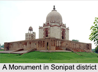
Sonipat district is one of the 21 districts of Haryana. Sonipat town is the district headquarters. It is a part of National Capital Region along with Delhi, Gurgaon, Faridabad, Noida, Ghaziabad. Sonipat district borders Delhi in south, Panipat District in the north, Jind District in the north-west, Uttar Pradesh state in the east with the Yamuna River acting as a border and Rohtak District in the west.
Panipat District
 Panipat district is blessed with the historical town of Panipat, which is the administrative headquarters of the district. The district occupies an area of 1268 square km, making it the 19th largest in the state with Gurgaon and Panchkula following it. This area is known in Indian history for the battles during Delhi Sultanate era and the Mughal Era.
Kurukshetra District
Kurukshetra district is headed by the town of Kurukshetra. It is a sacred place for the Hindus. It is the administrative headquarters of this district. The district occupies an area of 1682.53 km ². The district has a population of 825,454. This district is part of Ambala division.
Karnal District
Karnal district has the Karnal town which is the administrative headquarters of the district.
Jhajjar District
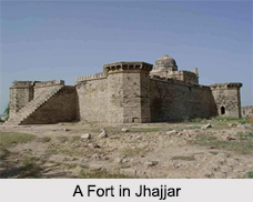
Jhajjar district is carved out of Rohtak district on 15th July 1997 and with its headquarters in Jhajjar. It lies 29 kilometres (18 mi) from Delhi and had developed into an important industrial center. Other towns in the district are Bahadurgarh and Beri. Jhajjar district occupies an area of 1,834 square kilometers and as of 2001 its population was 709,000. It has two industrial areas with 2408 plots. The basic industries in Jhajjar District are ceramics, glass, chemicals, engineering, electrical and electronics. There are 48 large and medium units along with 213 small-scale units. The major crops grown in Jhajjar District are rice, wheat and maize. The total irrigated agricultural land area is about 670 square kilometers.


