 Districts of Bengaluru Division include the districts like Bengaluru Urban District, Bengaluru Rural District, Chikballapur district, Chitradurga district, Davanagere District, Ramanagara district, Kolar District, Ramanagara district and Tumkur district.
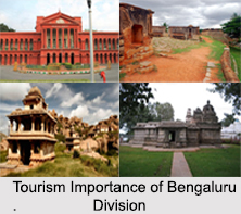
Bengaluru Urban District
Bengaluru urban District is a district of the Indian state of Karnataka. The Bengaluru Rural district on the east and north, the Ramanagara district on the west and the Krishnagiri district of Tamil Nadu on the south surround Bengaluru urban District. Bengaluru Urban district came into being in 1986, with the partition of the erstwhile Bengaluru into Bengaluru Urban District and Bengaluru Rural District.
Bengaluru Rural District
Bengaluru Rural District is one of the 30 districts in Karnataka. It was formed in 1986, when Bengaluru was divided into Bengaluru (Rural) and Bengaluru (Urban). Presently in Bengaluru Rural district, there are 2 divisions, 4 Talukas, 35 Hoblis (cluster of villages), 1,713 inhabited and 177 uninhabited villages, 9 towns, and 229 Gram Panchayats. Proximity to the city of Bengaluru has its own impact on the district, with a considerable daily commuting population. The rural people are mostly agriculturists, although with the advent of SEZs in the area, service and IT industries are booming. Bengaluru Rural District is set to be the site of a 95 billion Devanahalli Business Park, near the Bengaluru International Airport.
Chikballapura District
Chikballapura district is a district in the state of Karnataka. On 10th September 2007, Chikballapura district was carved out of the pre-existing Kolar district which was the fourth largest district of Karnataka by moving the talukas of Gauribidanur, Gudibanda, Bagepalli, Chikballapur, Sidlaghatta and Chintamani into the new district. Kannada is the official and most widely spoken language.
Chitradurga District
Chitradurga district is an administrative district of Karnataka. The city of Chitradurga is the district headquarters. Chitradurga gets its name from Chitrakaldurga, an umbrella-shaped lofty hill found there. The tradition dates Chitradurga District to the period of the Ramayana and Mahabharata. The whole district lies in the valley of the Vedavathi River, with the Tungabhadra River flowing in the northwest. During the British times it was named Chitaldroog. The district was practically ruled by all the well known dynasties that ruled Karnataka.
Davanagere District
Davanagere District is an administrative district of Karnataka. The city of Davanagere is the district headquarters. It had a population of 1,946,905 of which 32.31 percent was urban as of 2011.
Kolar District
Kolar district is a district in the state of Karnataka, India. Kolar is the district headquarters. Located in southern Karnataka, it is the state`s easternmost district. The district is surrounded by the Bangalore Rural district on the west, Chikballapur district on the north, the Chittoor district of Andhra Pradesh on the east and the Krishnagiri District and Vellore district of Tamil Nadu on the south.
Ramanagara District
Ramanagara district is one of the 30 districts of Karnataka state in southern India. Ramanagara town is the administrative headquarters of this district. The district is part of Bangalore Division.
Shivamogga District
Shivamogga district is a district in the Karnataka state of India. A major part of Shimoga district lies in the Malnad region of the Western Ghats Mountain Range in India. Shivamogga city is its administrative centre. Jog Falls is a major tourist attraction. As of 2011 Shimoga district has a population of 1,755,512. There are seven taluks like Bhadravathi, Hosanagara, Sagara, Shimoga, Shikaripura, Soraba and Thirthahalli.
Tumkur District
Tumkur district is an administrative district in the state of Karnataka in India. It was formerly the part of old Mysore State. It was formed in 1832 during the days of British commissioner of Mysore, Sir Mark Cubbon as Chitaldroog Division including the area of present Chitradurga District and Tumkur district headquartered at Tumkur.


