 Districts of Assam comprises of 33 administrative districts. The north eastern state of India, Assam is the land of hills and valleys with its capital at Dispur, Guwahati. Guwahati is the largest city in the state. Assam shares its borders with Meghalaya, Manipur, Arunachal Pradesh, Mizoram, Nagaland and Tripura. This state is famous for its tea gardens and contributes to 55% of the tea production of the country. 33 districts of Assam have been discussed below in brief:
Baksa District: It was declared and notified as a separate district in the month of October in 2003. It became functional from June 1st 2004.
Barpeta District: In Barpeta district the main attractions are Barpeta Satra, Chinpara Vithi, Sundaridiya Satra, Patbaushi Satra, Pari Hareswar Devalaya, Dargah of Syed Shahnur Dewan, Manas National Park etc.
Bongaigaon District: This is situated in the western part of Assam spread over an area of 2,510 sq. km. The main attractions of this district are Bageswari Temple, Bishnupur, Kakaijana Reserve Forest, Lalmati-Duramari Ganesh Mandir and Rock-Cut Cave.
Cachar District: Among the districts of Assam, Cachar is spread over an area of 3,786 sq. km. with its headquarters at Silchar. This district is drained by a number of rivers. The Barak, Chiri, Jatinga, Sonai, Dhaleshwari and Katakhal are the major rivers.
Darrang District: It is basically an agricultural district and the main crops produced here are wheat, rape, mustard, sugarcane and rice.
Dhemaji District: It is also one of the 33 districts of Assam, which has nine reserve forests and an important industry of the region is sericulture. It produces three different kinds of silk which have a huge demand in national and international market.
Dhubri District: It is one of the densely populated districts of Assam and is known for its scenic beauty with its fields and hills.
Dibrugarh District: It is spread over an area of 3,381 sq. km. out of which the Joypur reserve forest occupies an area of 1,066,608 hectares.
 Dima Hasao District: North Cachar Hills district, currently known as Dima Hasao district, is mostly covered with forests and the major forest reserves are the Barail Reserve Forest, Krungming Reserve Forest, and Langting Mupa Reserve Forest.
Goalpara District: It has several artificial ponds and a number of natural forest reserves.
Golaghat District: Among all the districts of Assam, this is one of the ideal tourist destinations with the Kaziranga National Park and the Nambor Wildlife Sanctuary.
Hailakandi District: Half of the total area of this district is covered with reserve forests.
Jorhat District: With its rambling tea gardens, it is the gateway to the northeast of Assam.
Kamrup District: It has its headquarters in Guwahati and is dotted with a number of temples. The Kamakhya Temple, Geeta Mandir, Aswaklanta, Balaji Temple and Navagraha Temple are the major temples of this district.
Karbi Anglong District: This is also one of the districts of Assam, which is rich in mineral deposits like limestone, china clay, feldspar and coal.
Karimganj District: It is drained by a number of rivers. The Kushiara, Longai, Singla, and Barak are the major rivers that flow through Karimganj.
Kokrajhar District: It covers an area of 3,129 sq km and is located on the north bank of the river Brahmaputra. The northern part of the district is well known for its panoramic beauty.
Lakhimpur District: This district of Assam is spread over an area of 2,277 sq. km. and is dominantly rural.
Morigaon District: It is situated on the Brahmaputra Valley and spread over an area of 1,704 sq. km. Patekibori Than, Pabitora Wildlife Sanctuary, Sitajakhala, Deosal, Kachasila Hill are major tourist attractions of the district.
Nagaon District: It was formed in 1839 and is one of the largest districts of Assam.
 Nalbari District: Dotted with numerous temples Nalbari District is an important religious destination. The famous temples are Hari Mandir, Billeswar Temple, Shripur Dewalay Mandir, Basudeb Devalay, and Shiva Mandir.
Sonitpur District: The economy of the district is largely based on agriculture and the major crops grown here are paddy, jute, sugarcane, tea, pulses and mustard.
Tinsukia District: It is an industrial district and some of the major towns of the district are Tinsukia, Digboi, Margherita, Doomdooma, and Makum.
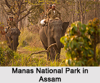
Udalguri District: It is also one of the 33 districts of Assam, which houses the Manas National Park with an area of 500 sq. km.
Sibsagar District: It is a chief tea and oil producing district.
West Karbi Anglong District: It is a new district formed out of the Karbi Anglong district of Assam in 2016.
Biswanath District: It is one of the new districts of Assam, which was formed in 2015. It was declared a district by the Chief Minister of the state on 15th August 2015.
Charaideo District: This is also one of the newly formed districts of Assam. Sonari is the headquarters of this district.
Chirang District: This district of Assam, also called Narshingbari district, is an administrative district in BTAD area of Assam.
Hojai District: Hojai, one of the newly formed districts of Assam, has its headquarters in Hojai.
Kamrup Metropolitan District: It was carved out of the erstwhile undivided Kamrup district in 2003 and covers an area equivalent to the area under the jurisdiction of the Guwahati Metropolitan Development Authority area.
Majuli District: This is the niggest river island in the world in Brahmaputra River.
South Salmara-Mankachar District: Hatsingimari village is the headquarters of this district.


