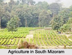
 Districts of South Mizoram include the Siaha District, Lawngtlai district, and Lunglei district.
Siaha District
Siaha District is one of the eight districts of Mizoram. The district is bounded on the north and northwest by Lunglei district, on the west by Lawngtlai District and on the south and east by Myanmar. The district occupies an area of 1399.9 square kilometers. The Saiha town is the administrative headquarters of Siaha District. The population had decreased from 60,823 (in 2001 census) to 56,574. It is the least populous district of Mizoram. The majority of Siaha District inhabitants are Mara people, who also have an autonomous district council called Mara Autonomous District Council composed of the two R.D. Blocks of Saiha and Tuipang; the Lai people, on the other hand, are the main inhabitants of Sangau R.B block, which is part of the Lai Autonomous District Council.
Lawngtlai District
Lawngtlai district is one of the eight districts of Mizoram state. The district is bounded on the north by Lunglei district, on the west by Bangladesh, on the south by Myanmar and on the east by Saiha district. The district occupies an area of 2557.10 square km. Lawngtlai town is the administrative headquarters of the district. The district shares its boundaries with Lunglei District and Saiha district on the north and south respectively. The inhabitants of Lawngtlai district are mainly the ethnic groups of tribals like Lai and Chakma, who are among the minor tribal communities of Mizoram. The main occupation is cultivation and the rural population largely depends on agriculture for their subsistence. The physical feature is mainly hilly except with long narrow strip of low-lying area along the western side of Chamdur Valley.
Lunglei District
Lunglei district is one of the eight districts of Mizoram state. As of 2011, it is the second most populous district in the state, after Aizawl. Lunglei district is bounded on the north by Mamit district and Aizawl district, on the west by Bangladesh, on the south by Lawngtlai district, on the southeast by Saiha district, on the east by Myanmar and on the northeast by Serchhip District. Lunglei district occupies an area of 4538 square km. Lunglei town is the administrative headquarters of the district. Lunglei district is named after its headquarters, Lunglei. It derived its name from a bridge like rock found in the riverine area around the Nghaish, a small tributary of the river Tlawng.


