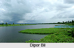
 Dipor Bil, situated in the southwest of Guwahati in Kamrup district of the Indian state Assam, is a permanent freshwater lake. The lake is in a former channel of the Brahmaputra River, located at the south of the main river. Also spelt as Deepor Beel, it has been enlisted as a Ramsar Site for undertaking conservation measures on the basis of its biological and environmental significance by the Ramsar Convention since November 2002. Dipor Bil is regarded as a representative of the wetland type under the Burma Monsoon Forest bio-geographic region. It is also credited amongst the largest Beels in the Brahmaputra valley of lower Assam.
History of Dipor Bil
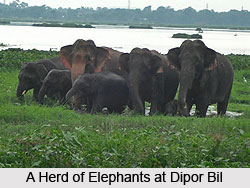
The name Dipor Bil has been derived from the Sanskrit word `Dipa` which refers to Elephant and `Beel` which signifies a large aquatic body or wetland inhabited by elephants in Assamese language. Historical records suggest that it served as a significant dockyard of the Tai-Ahom and later Mughals.
Geography of Dipor Bil
Dipor Bil is surrounded in the north and south by steep highlands. The valley formed in between exhibits a broad `U` shape having Garbhanga and Rani hills as magnificent backdrops. As per the tectonic and geologic history, Dipor Bil is assumed to be an abandoned channel of the Brahmaputra system. The Beel, along with its lowland fringe comprises recent alluvium including silt, sand, clay and pebbles. Towards the south and north of the lake, the highlands are composed of gneisses and schists of the Archaean age. The main source of water for the lake is Kalmani and Basistha rivers. It finally drains into the Brahmaputra River through Khonajan channel. The average temperature of Dipor Bil varies from 10.6 to 32 degree Celsius.
 During winters the size of the lake reduces substantially and the cultivation of paddy is done in the shore area. From May to September the place enjoys tropical monsoon climate while between the periods of March and May the place experiences pre-monsoon showers.
Flora of Dipor Bil
The hydrophytic vegetation of Dipor Bil has been categorized on the basis of ecological adaptation. Aquatic vegetation of the lake comprises water lilies, aquatic grasses, water hyacinth and many other floating and submerged type of vegetations. About 18 genera of phytoplankton have been recorded in the core area of Beel ecosystem. The deciduous forest of the nearby region constitutes plants like Bombax malabaricum, Shorea robusta, Ficus benghalensis and Tectona grandis. In the adjoining areas of Dipor Bil several species of medicinal plant, aquarium plants and orchids are found.
Fauna of Dipor Bil
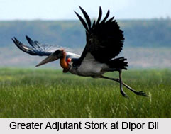
Resident and migratory waterfowl can be commonly seen in the scattered forest areas, dry grassland and paddy fields. It forms the natural habitat for a vast variety of birds which number about 219 out of which 70 are migratory species. In winters large assemblage of aquatic birds can be seen. It has been declared as an Important Bird Area by the Birdlife International having a high priority for conservation. Common birds spotted here include Greater Adjutant Stork, Pallas` Sea Eagle, Siberian Crane, Spotbilled Pelican, Lesser Adjutant Stork and many more. Around 6 Turtle and Tortoise, 18 Snakes, 12 Lizards and 20 Amphibian species are the inhabitants of the region along with 50 commercially viable fish species. The surrounding areas also host animals like Sambar, Chinese Porcupine, Barking Deer, Jungle Cat, Leopard, Asian Elephants and others.
 Significance of Dipor Bil
The natural resources of Dipor Bil, directly as well as indirectly help in the livelihood of fourteen indigenous villages situated nearby. The health of the village dwellers is dependent on the ecosystem of this wetland. Freshwater fishes are a prime source of income for the communities. Fishing is a common activity in Dipor Bil practiced by the nearby villagers. The lake also aids the transport of villagers. It is also a source of cattle fodder and a site for growing Boro paddy.
The natural resources of Dipor Bil is presently encountering much deterioration owing to natural and anthropogenic causes including expansion of human settlements, disposal of wastewater, hunting of birds, intensive fishing practices and many other issues. However to prevent further damage a comprehensive management plan has already been undertaken for its protection and conservation. It has also been notified as a bird sanctuary encompassing the larger spread of the Beel.


