 Dams in Maharashtra have been constructed on several rivers like Mula River, Bhima River, Godavari River, etc. These dams aim at meeting the drinking water requirements of the different cities, towns and villages in Maharashtra. Power plants have been constructed at some of the dam sites to generate hydroelectricity. As some of the dams in Maharashtra are situated in the middle of lush green natural settings, tourists from different regions of India are attracted to the dam site. There are almost 1821 noteworthy dams in Maharashtra. Described below are some of the most prominent dams in Maharashtra.
Mula Dam
Inaugurated in 1972, the Mula Dam is situated near Rahuri in Ahmednagar district and is known to be one of the biggest dams in the region. The dam was constructed with the objective of supplying drinking water to Ahmednagar district and Rahuri. The reservoir of Mula Dam is known as "Dnayneshwar Sagar". The site of the Mula Dam is one of the renowned places of attractions in Maharashtra because of its scenic surroundings.
Koyna Dam
Koyna Dam has been constructed on Koyna River. It is located in Koyna Nagar, Satara district. The dam is mainly utilized to generate hydroelectricity. It also fulfils irrigation requirements in the neighbouring areas. The construction of Koyna Dam commenced in 1956 and was opened for operations in 1964.
Panshet Dam
Constructed on the Ambi River, the Panshet Dam is a multipurpose project, which is located about 50 km from Pune and about 180 km from Mumbai. The dam was erected around 40 years back for irrigation of agricultural lands. This dam is one of the major sources of water in Thane district. It also helps in the generation of hydroelectricity. The height of Panshet dam is around 63.56 m and its length is nearly 1,039 m.
 Mulshi Dam
Mulshi Dam has been built on Mula River and is located in Pune district. Water from this dam is used for irrigation. Tata Power Company Limited operates the Mulshi Dam for producing electricity at the Bhira Hydroelectric Power Plant. The power generated in the station is mainly supplied to the capital city of Mumbai.
Bhandardara Dam
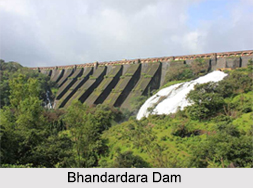
Bhandardara Dam or Wilson Dam has been constructed on Pravara River. It is located in Ahmednagar district. The construction of the dam was completed in 1926. Reputed to be one of the oldest dams in Asia, the Bhandardara Dam was erected at an elevation of about 750 meters from mean sea level. The dam has tourism value, with the major attraction being the Umbrella Falls and the Randha Falls, which is situated at a distance of about 11 km from the dam.
Vaitarna Dam
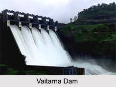
Vaitarna Dam has been constructed on Vaitarna River. It is located in Palghar and Nashik districts. The dam has been segregated into three parts, as per the flow of Vaitarna River. The three parts are Upper Vaitarna Dam, Middle Vaitarna Dam and Lower Vaitarna Dam. The Upper Vaitarna Dam is located at a scenic site, about 20 km from Khodala in Thane district. It is regarded as a major source of water in the city of Mumbai.
Jayakwadi Dam
Jayakwadi Dam has been built on Godavari River. It is situated in the village of Jayakwadi in Paithan taluka of Aurangabad district. The dam is located at a distance of around 110 km from Ahmednagar district. It has a total catchment area of about 21,750 sq. km. The dam provides water to Aurangabad and produces abundant hydroelectric power. The dam also has a reservoir of its own called the Nath Sagar Jalashay.
 Ujani Dam
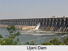
Ujani Dam has been built on Bhima River and is located near Ujjani village of Madha taluk in Solapur district. The dam possesses a vast catchment area and a large area is covered by the backwaters of Ujani Dam. The dam is considered to be a tourist destination of Maharashtra.
Pawna Dam
Pawna Dam has been constructed across Pawna River. It is situated in Pune district in close proximity to Lonavala. The vicinity of the dam is famous as one of the most renowned tourist destinations of Maharashtra. Ferry services across the dam foster tourism in Lonavala.
Girna Dam
Girna Dam is located in Nashik district, which is drained by two chief rivers namely, the Girna River and the Godavari River. The main purpose behind the construction of the dam was to collect water of the river for irrigation, especially during rainy season.
Kolkewadi Dam
Kolkewadi Dam is situated in the Konkan region of Maharashtra. The dam is a vital part of Koyna Dam Hydroelectric Project. The space behind the Kolkewadi Dam is one of the most sparsely populated regions of Maharashtra.
Other Dams in Maharashtra
Yeldari Dam, constructed on the Purna River has a hydel power station to generate hydroelectricity. Manair Dam has been built on Manair River. Radhanagari Dam has been constructed over Bhagawati River. Nandur Madhmeshwar Dam site is known for Nandur Madhmeshwar Bird Sanctuary.


