 Dams in Kerala are well known for their architecture and building components. The south Indian state of Kerala is known for its natural beauty and here several dams constructed check the flow of water and also serve the purpose of generation of hydroelectricity. They are also major sources of water for irrigation and drinking purposes. Waters in the reservoirs of the dams in Kerala also provide drinking water to the nearby areas. Most of the sites of dams in Kerala act as tourist destinations. Given below are the Dams in Kerala.
Malampuzha Dam
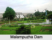
Malampuzha Dam is a major dam of Kerala situated near Palakkad. The construction of the project was initiated in the year 1949 and was over by the year 1955. The dam is the largest reservoir of the state. Malampuzha Dam is a masonry dam which is about 1,849 meters in length and an earthen dam which is about 220 meters in length. Its total height is about 6,066 feet. The canal systems supply water for the irrigation of farm lands, while the reservoir takes care of the drinking water requirements of Palakkad and a number of nearby villages. The dam is one of the major places of tourist attraction in Kerala.
Mangalam Dam
Mangalam Dam is located across Cherukunnapuzha River near Palakkad in Kerala. The objectives behind the construction of the dam were storage of water for producing hydroelectricity and providing water for irrigation in the region. The construction of the canal systems for the purpose of irrigation was over and the dam started to function in the year 1966, in the Alathur taluk of the district of Palakkad.
Banasura Sagar Dam
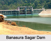
 Banasura Sagar Dam is situated at a distance of about 21 km from Kalpetta in Wayanad District. It is a part of the Indian Banasurasagar Project, which was initiated in the year 1979. The project was a canal and a dam construction project. The main aim of the project was to support the Kakkayam Hydro Electric Power Project and cater to the demands of irrigation and drinking water in areas facing the problem of water scarcity in seasonal dry periods.
Peechi Dam
Peechi Dam is situated at a distance of about 23 kilometers from Thrissur. It is a notable dam in Kerala and is also one of the oldest dams in the state. Peechi Dam Project firstly came up as a project of irrigation, but afterwards the project catered to the drinking water requirements of the people living in the region. The reservoir of this dam provides boating facilities to the visitors, which encourages more number of tourists to visit this place to enjoy boating and the natural beauty of the surrounding. Peechi Dam is a popular place for picnics as well.
Parambikulam Dam
Parambikulam Dam is situated very close to the Udumalaipettai city. This dam was planned in the form of an embankment dam over Parambikulam River in Palakkad District. It is well-known as one of the premium dams in India and also as one of the best embankment dams in the entire world in terms of volume capacity, as documented in the year 2000.
Mullaperiyar Dam
Mullaperiyar Dam, a major dam in Kerala was constructed over the headwaters of the Periyar River. It is located on the Cardamom Hills of the Western Ghats in Thekkady, Idukki District, about 881 m above mean sea level. Its construction commenced in the year1887 and the dam was opened for functioning in the year 1895.
Neyyar Dam
Neyyar Dam of Kerala was founded in the year 1958 in Thiruvananthapuram district. It was opened in the year 1958 and is operated by the state government of Kerala. This picnic spot has a height of about 56 m (184 ft), length of about 295 m (968 ft) and a structural volume of about 105,000 cubic meters.
Walayar Dam
Walayar Dam stands across the Walayar River. The construction work of the dam was completed in the year 1964 and in the same year it started functioning. This popular dam of Kerala is a primary source of irrigation in the entire surrounding areas.
Idukki Dam
Idukki Dam stands across Periyar River in the canyon lying between the Kuravan and Kurathi Hills in Kerala. It is one of the highest arch dams in Asia. Idukki dam rises to an elevation of about 167.68 meters.
Vazhani Dam
Vazhani Dam, one of the biggest dams in Kerala has been built across the Wadakkancherry River near Wadakkancherry in the district of Thrissur. It is made purely of clay and serves irrigation and drinking purposes.
Chulliyar Dam
Chulliyar Dam is located in Muthalamada Panchayat in Palakkad. It was constructed in the year 1960, across Chulliyar River. This dam provides water to the nearby villages. The dam is a place of natural beauty and acts as a tourist destination.
Siruvani Dam
Siruvani Dam is located in Palakkad District across the Siruvani River. It was opened in the year 1984 and provides drinking water to the city of Coimbatore in Tamil Nadu.
Meenkara Dam
Meenkara Dam has been built across Gayathri River, which joins the Bharathapuzha River. The dam is situated about 39 km from Palakkad in Kerala. The dam was built in the year 1964. The dam area is full of greenery and has paddy and coconut fields.
Kundala Dam
Kundala Dam is located at a distance of around 20 km from Munnar. This dam is an artificial dam and has the distinction of being Asia"s first arch dam. The dam provides benefits to the entire Kundala town. The dam site offers boating facilities to the tourists.
Kanjirapuzha Dam
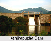
Kanjirapuzha Dam, situated in the Palakkad District of Kerala is enfolded by hills. The construction of this masonry earth dam commenced in the year 1961 and the dam was opened for operations in the year 1995. The dam was constructed with the aim to start irrigating a cultural command area of about 9,713 hectares.
Chalakudy Dam
Chalakudy Dam has been built across Chalakudy River in the district of Thrissur in Kerala. Also known as the Sholayar Dam, it is located at a distance of about 65 km to the east of Chalakudy town.


