 Dams in Karnataka have been constructed across several Indian rivers flowing throughout the state. In Karnataka, about 9 rivers flow in different places and the water of these rivers are used for several purposes like irrigation, drinking and hydro-electric power generation, with the help of dams. Given below are the Dams in Karnataka.
Krishna Raja Sagara Dam
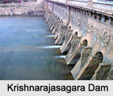
Krishna Raja Sagara Dam, located in Mysore has been constructed across River Kaveri. The dam serves the purpose of irrigation in Mysore and Mandya and provides drinking water to Mysore city and almost the whole of Bengaluru. The water released from the dam is also significant for the Indian state of Tamil Nadu. The famous Brindavan Gardens is located in the yard of the Krishnarajasagara Dam. These gardens are very elegantly decorated and have several colorful fountains.
Linganamakki Dam
 Linganamakki Dam is situated in Sagara taluk and has been built across Sharavathi River. The state government of Karnataka erected the Linganamakki Dam in the year 1964. It has a length of around 2.4 kilometers. There is a huge reservoir behind the dam and the release of water from the dam is quite heavy. Linganamakki Dam is considered to be a popular tourist attraction.
Supa Dam
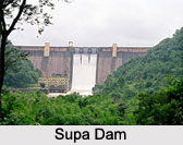
Supa Dam is a significant reservoir of Karnataka, situated in Uttara Kannada District. It stands across Kali River. The main purpose of constructing the dam was to produce power. Karnataka Power Corporation (KPCL) had constructed this dam and the electric power generating station successfully serves the purpose of generating hydroelectric power. The electricity produced by this dam is supplied to diverse parts of the state.
Kadra Dam
Kadra Dam, a notable dam in Karnataka is located in the Uttara Kannada District. It stands on Kalinadi River. The vital purpose to erect this dam was to initiate a hydroelectric project for the supply of water to turbines of electric power generating station. KPCL is known to complete the project.
Tunga Bhadra Dam
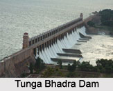
Tunga Bhadra Dam has been built on the Tungabhadra River. Tunga Bhadra Project is known to be a combined endeavor of Andhra Pradesh and Karnataka. The dam is about 2441 meters in length and about 49.38 meters in height.
Harangi Dam
Harangi Dam is a reservoir cuddled in north Kodagu in Kodagu district. It is located at a distance of about 36 kilometers from Madikeri. The length of this dam is around 846 meters and its height is about 47 meters. It is considered to be one of the well-known dams in Karnataka. The dam is an ideal picnic spot and is renowned for its calm environment. 
Alamatti Dam
Alamatti Dam stands across the Krishna River. This dam is the principle reservoir of the Upper Krishna Irrigation Project. There is a 290 megawatt power station situated on the right side of the Almatti Dam. This popular dam benefits the states of Karnataka, Andhra Pradesh and Maharashtra.
Hemavathy Dam
Hemavathy Dam is situated in Gorur, near the city of Hassan in Karnataka. It has been constructed across the River Hemavathy. It was constructed in the year 1979. The dam is utilized for supplying drinking water and irrigation. The catchment area of the dam is about 2,810 square kilometers.
Basava Sagara
Basava Sagara is a dam and a reservoir across the Krishna River at Narayanapur in Yadagiri District in Karnataka. This dam only serves the purpose of irrigation.
Other Dams in Karnataka
Some of the other Dams in Karnataka are Alalur Dam, Almatti Dam, Balakundi Dam and Bharatagi Dam.


