 Dams of Jammu and Kashmir have been constructed with the main purpose of power generation. Apart from generating power, the dams of the valley also add to its tourist attractions of the state. The inflow of tourists to these dam areas is an important area of business for Jammu and Kashmir. These power projects also serve the neighboring states. Discussed below are some of the Dams of Jammu and Kashmir like the Salal Project, Baglihar Dam, Chutak Hydroelectric Project, Dumkhar Hydroelectric Dam and Uri Hydroelectric Dam, Pakal Dul Dam, Nimoo Bazgo Dam and Dulhasti Dam.
Salal Project
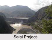
Salal Project is a major dam of Jammu and Kashmir. The Salal Project mainly deals with the power generation function in Jammu and Kashmir and the power station has a capacity of producing around 690 megawatt of electricity and annually it generates around 3101 million units of electricity. The power project has been constructed on the Chenab River in the Udhampur district of Jammu and Kashmir. The dam is supervised by the National Hydroelectric Power Corporation (NHPC). The power project has been serving the states of Jammu and Kashmir, Uttar Pradesh, Punjab, Haryana, Himachal Pradesh, Delhi, Rajasthan and Chandigarh, since its construction. It has 6 power generating units altogether and the capacity of each of this units is about 115 megawatt.
Baglihar Dam
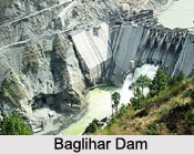
Baglihar Dam or Baglihar Power Project is also a major dam of Jammu and Kashmir. It has also been constructed on the Chenab River, but in the southern Doda district of the state. The construction of the project began in the year 1999 and the first phase of its construction was completed in 2000 after its construction plan was commissioned in 1992. This power project has a capacity of around 450 megawatt and was dedicated to the nation by Manmohan Singh, the then Prime Minister of India on 10th of October, 2008. 
Chutak Hydroelectric Project
Chutak Hydroelectric Project is a run-of -the-river power project on Suru River. The project construction began on September 23, 2006 and was commissioned by February, 2011. The project envisages utilizing a gross head of about 63.4 m to generate electricity of about 216.41 gigawatt hours with an installed capacity of about 44 megawatt. Each 11 megawatt underground generating unit will operate under a rated head of about 52 m and a rated discharge of about 24.05 cubic meters per second.
Dumkhar Hydroelectric Dam
Dumkhar Hydroelectric Dam has been constructed on the Indus River in the Leh district of Jammu ands Kashmir. It is a 42 m high and 220m long concrete gravity dam across Indus River.
Uri Hydroelectric Dam
Uri Hydroelectric Dam is a 480 megawatt hydroelectric power station on the Jhelum River near Uri in Baramula district of Jammu and Kashmir. It is located very near to the de-facto border between India and Pakistan. The project has been largely built under a hill with a 10 km tunnel. It is of the run-of-the-river type without a large dam, since the Indus Waters Treaty gives Pakistan the exclusive right to regulate the Jhelum River.
Pakal Dul Dam
Pakal Dul Dam is located in Kishtwar district of Jammu and Kashmir and has been built on the Marusadar River, a tributary of the Chenab River. This embankment and concrete-face rock-fill type of dam has a height of about 167 m (548 ft). The dam was constructed with the aim of producing hydroelectric power. The name of the power station is Pakal Dul Hydroelectric Power Station.
Nimoo Bazgo Dam
Nimoo Bazgo Dam is located in Leh (Ladakh) district of Jammu and Kashmir and has been built on the Indus River. The dam has a height of about 57 m and a length of about 247. It was completed in the year 2014. The dam was constructed with the aim of generation of hydroelectricity.
Dulhasti Dam
Dulhasti Dam is located in Kishtwar district of Jammu and Kashmir and has been built on the Chenab River. The dam has a height of about 65m and a length of about 186 m. It was completed in the year 2006. The dam was constructed with the aim of generation of hydroelectricity.
Other Dams of Jammu and Kashmir
Four other Dams of Jammu and Kashmir are Kishenganga Dam, Niu Karewa Storage Yusmarg Dam and Sewa St II Dam.


