 Damodar Valley Corporation (DVC) is a governmental organization which operates several power stations in the Damodar River area of West Bengal and Jharkhand states of India. The corporation operates both thermal power stations and hydel power stations under the Ministry of Power, Govt of India. DVC headquarter is located in the city of Kolkata, West Bengal.
The Damodar Valley Corporation (DVC) was based on the idea of Tenesse Valley Authority of the United States of America. Launched on the river Damodar, this DVC project benefits the states of West Bengal and Bihar. An important feature of this project is the 692 meters long and 11.6 meters high barrage constructed across the Damodar at Durgapur. The Right Bank canal and the Left Bank canal, which are getting originated from the barrage, are used for irrigation and navigation respectively. This project constitutes three thermal powerhouses at Bokaro, Chandrapura and Durgapur.
History of Damodar Valley Corporation
DVC emerged as a culmination of attempts made over a whole century to control the wild and erratic Damodar River. The valley has been ravaged frequently by floods at different intensities. The river spans over an area of 25,235 sq. km, which covers the states of Bihar, Jharkhand and West Bengal. The 1943 flood led to serious public indignation against the Government. As a result of which, the Government of Bengal appointed a board of Enquiry. It was titled "Damodar Flood Enquiry Committee"; it took place with the Maharaja of Burdwan and the noted physicist Dr. Meghnad Saha as members for suggesting remedial measures.
The Damodar Flood Enquiry Committee suggested the creation of an authority, which would be similar to the Tennessee Valley Authority in the USA, and they recommended the construction of dams and storage reservoirs with a total capacity of 1.5 million acre ft. and highlighted the possibilities of multipurpose development in the valley area.
In April 1947, full agreement was practically reached among the three Governments of Central, West Bengal and Bihar on the implementation of the scheme. In March 1948, the Damodar Valley Corporation Act was passed by the Central Legislature, requiring the three Governments- the Central Government, the State Governments of West Bengal and Bihar to participate jointly for the purpose to build the Damodar Valley Corporation. The Corporation came into existence on 7th July 1948 as the first multipurpose river valley project of independent India.
Infrastructure of Damodar Valley Corporation
DVC has developed and expanded its infrastructure to six thermal power stations and three hydro-electric power stations with a capacity of 147.2 MW. They contribute to a total installed capacity of 7557.2 MW. Presently DVC has 49 sub-stations and receiving stations more than 8900-circuit km of transmission and distribution lines. DVC has also four dams, a barrage and a network of canals that play a vital role in water management.
Network of Dams under DVC
DVC has a network of four dams and they are- Tilaiya and Maithon on Barakar River, Panchet on Damodar River and Konar on Konar River. Details of the dams are mentioned below:
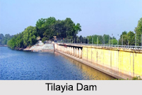
 Tilaiya Dam: Built across the river Barakar and the main tributary of Damodar, Tilaiya dam is 30 meters high and 366 meters long. There are two powerhouses, each having a capacity of 2000 kilowatts.
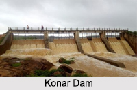
Konar Dam: It is located in the Hazaribagh district on the Konar River, a distributary of the Damodar. This dam has a height of 49 meters and length of 3548 meters.
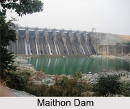
Maithon Dam: The main purpose of this dam is flood control. Constructed on the Barakar River, this is located 26 kilometers away from the Asansol railway station. It is 94 meters high and 144 meters long. There are three hydel power units, each with a capacity of 20,000 kilowatts.
Panchet Hill Dam: This 2545 meters long and 45 meters high dam is an earthen dam. It is constructed across the river Damodar in the Dhanbad district. Its single hydel power unit has a capacity of 40,000 kilowatts.
Roles and Functions of Damodar Valley Corporation
DVC has constantly been trying to develop the infrastructure of West Bengal, Bihar and Jharkhand. Their managements in distributing electricity, managing the water resources, conserving forests, community services have played a vital role in developing the infrastructure of the states. Below are some details of the functions:
Distributing Electricity: DVC has devised a dense network of 220 KV and 132 KV Transmission and Distribution system for supplying power to its consumers via the power stations. This system comprises of about 4,761 circuit Km Transmission Lines, and 44 Sub-stations.
Conservation of Forests: Watershed management and other allied tasks are performed periodically by DVC to conserve forests. Watershed management mainly constitutes controlling soil erosion and augmenting the life span of DVC reservoirs by curtailing the flow of debris that lead to silt deposition. The other tasks include planting trees, managing the soil, building check dams, protecting or reviving the land and rehabilitating denuded forests. More than 16,000 check dams and silt detention structures have already been built.
 Community Service: A `Social Integration Programme` was started in 1981 by DVC. The program is aimed at developing agriculture, education, health, self employment, social forestry, sports and culture, infrastructure and rural electrification.
Benefits of DVC Projects
There are several eventual benefits of the projects that are being handled by DVC. And all those facilities make Damodar Valley one of the key industrial regions of West Bengal. The benefits are mentioned below:
Building dams and thermal power stations.
Irrigating large hectares of land in Hooghly, Howrah, Bankura and Burdwan districts in West Bengal
Controlling floods
Transportation through canals
Checking soil erosion by planting trees
Anti-malaria drives


