 Daman and Diu was part of the Portuguese Empire from late medieval era till Indian independence. It was incorporated into the Republic of India on 19th December 1961.Daman and Diu became a separate Union Territory in India after Goa got separated as an Indian state.
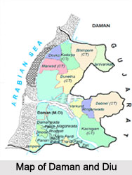
Daman and Diu are actually two parts, both on the seaside and both enclosed by Gujarat. Daman is near Surat in the South of Gujarat while Diu is near Junagadh District in the Saurashtra of Gujarat. Daman is a small part in the Gulf of Khambhat (Cambay) while Diu is an island joined to the mainland of Gujarat by a creek.
History of Daman and Diu
The history of Daman and Diu traced back from the time of Rajput rule from 8th Century to 13 Century. It was part of Goa and during that time Goa was a stronghold of the Chowda Rajputs who were later expelled by Waghalas who in turn were expelled by Muslims in1330 AD. The Portuguese ruled Goa for 451 years (1510-1961). Alfonso de Albuquerque entrenched himself in the Island of Tiswadi in 1510. When Bahadur Shah was attacked by Humayun he entered into an alliance with the Portuguese and allowed them to construct a fortress on the Island in the present Daman and Diu and keep up a fort there. The Treaty of 1543 finally confirmed the termination of Diu to the Portuguese. After Independence of India in 1947, Goa was annexed by Indian Government (Operation Vijay) with the help of Indian Army, which resulted in the end of 451 years long rule of Portuguese Empire in India.
Geography of Daman and Diu
Daman and Diu is situated on the west coast of India between the parallels 20 degrees 27 minutes 58 seconds and 20 degrees 22 minutes 00 seconds of latitude north and between the meridians 72 degrees 49 minutes 42 seconds and 72 degrees 54 minutes 43seconds of longitude east of Greenwich. The total are of the district is 72sq.km. Daman ganga River divides Daman into two parts.
 Demography of Daman and Diu
The territory constitutes an area of 112 sq. km. According to the Population Census in the year 2011, the population of the area is about 242,911. Out of which, there are 150,100 males and 92,811 females. The literacy of the state is 87.07 percent. Out of which the male literacy rate is 91.48 percent and the female literacy rate is 79.59 percent. The main languages spoken by the people are Gujarati, Marathi and English.
Culture of Daman and Diu
Daman and Diu has a rich multi faceted cultural heritage. The people of Daman and Diu follow the same customs and traditions as that of the people in Gujarat. The people live according to the Hindu system prevailing in the adjoining Gujarat territory. Dance and music are a part and parcel of their life. There is an amalgamation of cultures and festivals i.e. tribal, urban, European and Indian. This amalgamation is reflected in the people`s dances. Various Portuguese dances are still in vogue.
Education of Daman and Diu
 Daman, the capital city of Daman and Diu has many educational institutions like Institute of Our Lady of Fatima, Coast Guard Public School, Sarvajanik Vidyalaya and many more.
Administration of Daman and Diu
Daman and Diu is governed by an administrator appointed by the President of India. Daman and Diu has only two districts like Diu District and Daman District.
Economy of Daman and Diu
Agriculture is an important economy of Daman. The important food crops grown here are millets, jowar, wheat, oilseeds, sugarcane, mango, and pulses. Through the provision of irrigation facilities double cropping has been introduced. The Damanganga Project which is located in the Dadra and Nagar Haveli, is a joint venture of the state of Gujarat and Goa and the Union Territory of Daman and Diu and Dadra and Nagar Haveli. Fishing is also a main economic activity here. Cattle, buffaloes, sheep`s and goats are the main livestock and animal husbandry industries.
Tourism in Daman and Diu
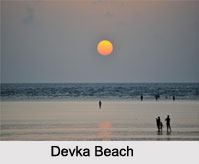
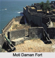
Daman and Diu is attracted to the global tourists for the beaches, temples, tribal areas and the amusement parks. Devka Beach, Jampore beach, Church of Bom Jesus, Nagoa Beach, Gangeshwar Temple, Our Lady of Rosary Chapel, Moti Daman fort, Nani Daman fort, Our lady of Sea Church, Hilsa Aquarium, Kachigam Water Tank, Hathi Park, Bridge Side Garden, Municipal Children Park, Ahmedpur beach, Mandvi beach, Chakratirath beach, Jallandhar beach, and Gomtimata beach are the popular spots in Daman and Diu.


