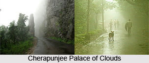
 Cherrapunji is a town in the East Khasi Hills district in the state of Meghalaya in India. It receives large amount of rainfall and is regarded as one of the world`s wettest places. It is an impressive place with its gushing waterfalls and the deep gorges. You get stunning views of the plains of bangladesh from here. However, in spite of perennial rain, Cherrapunji faces severe scarcity of water. Irrigation is also hindered due to too much rain, which washes away the topsoil as a result of human infringement in the forests.
The exact geographical location of the town is at 25.30 degree North and 91.70 degree East. It has an average elevation of 1484 meters (4872 feet). The town lies on the southern tip of a plateau that overlooks the country of Bangladesh. The cliffs of Cherrapunji are the first to be struck by the moisture carried by the winds over the Bay of Bengal. Unfortunately, all the rain falls on parched, deforested land. As there is no reservoir to stock up the rainwater, it speedily runs down the hill towards the plains of Bangladesh. Cherrapunji experiences an annual rainfall of 11,430 mm (450 in).
Cherrapunji gets both the Southwest and Northeast monsoon showers. Cherrapunji lies at an altitude of 1,370 m (4,500 feet) in the Khasi Hills. It lies on the windward side of these hills. Due to orographic rainfall, the rain-bearing clouds are forced to dump much of their moisture and rain on these hills from June to September. In the winter season the town receives the northeast monsoon showers, which travel down the Brahmaputra valley.
The town went up in the Guinness world records two times, once for receiving the maximum amount of rainfall in a single year: 22,987 mm (904.9,973 inches) of rainfall between August 1860 and July 1861 and secondly for receiving the maximum amount of rainfall in a single month: 9299.96 mm (366.14 inches) in July 1861.
 The town of Cherrapunji receives rainwater from the Bay of Bengal wing of the Indian Summer Monsoon. Intermittently, rainstorms can occur in one part of Cherrapunji whereas other areas may be completely or relatively dry showing high spatial variability of rainfall. Atmospheric dampness is exceedingly high during the peak monsoon period. Most of the rain in Cherrapunji falls during the morning hours. This could be partly due to two different air masses coming together.
During the monsoons, the existing winds along the Brahmaputra valley commonly blow from the east or the northeast. On the other hand, the winds over the state of Meghalaya are from the south. The convergence of these two winds systems usually occurs near the Khasi Hills. The winds that are locked in the valley at night begin their upward rise only after they are warmed during the day.
Cherrapunji with a population of 10,086, has 49% males, 51% females and 19% children less than six years of age. Out of the males, 74% are literate and out of the females also, 74% are literate.
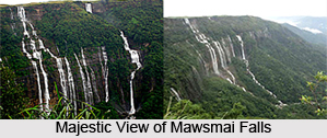
There are many places to visit in the town of Cherrapunji. The Mawsmai Falls, with a height of 1,035 ft are the 4th highest in India. They are situated at a distance of a few kilometres from Cherrapunji. The Khasi monoliths located closes by are a cluster of underground passages underneath ancient caves. The town produces high quality oranges and pineapples.
The local people of Cherrapunji are known as Khasis. Women are given priority here. After the marriage ceremony the husband goes to live with his wife`s family and the offspring take on the surname of the mother.
