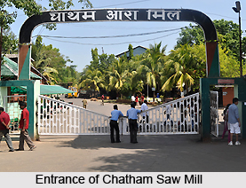
 Chatham Island is situated within the Andaman and Nicobar Islands, specifically within the South Andaman administrative district, which is a constituent of the Indian union territory of Andaman and Nicobar Islands. This island is positioned approximately 3 kilometers to the north of downtown Port Blair. The island houses Asia`s Largest Saw Mill.
Location of Chatham Island
Chatham Island became the dwelling place for the people when the British East India Company settled there. The tiny Island of Chatham is located near the Port Blair, about 5 km from the Airport at 11 degree and 41 minutes North latitude and 92 degree and 43 minutes East longitude with an area of 7.3 hectares of Land. Chatham Island is five kilometres northwest of Aberdeen Bazaar. This bazaar is well connected to Port Blair through a tiny land strip, with the sea lapping on both sides.
History of Chatham Island
In the year 1789, Chatham Island became the industrial establishment of the British settlement during the Governor Generalship of Lord Cornwallis in the early British period. The British East India Company founded the first penal settlement in 1858, with 200 prisoners, mostly rebels from the Indian Army who militated against the suzerainty of British East India Company during the First War of Independence that occurred in 1857.
The British Government in India built the Chatham Sawmill, which is known as the Asia`s Largest Saw Mill. It is one of the oldest and largest timber processing plants in India. Dating back to 1836, the enormous workshops are built in the durable and expensive Padauk wood, which was abundant in Andaman and Nicobar Islands. Since the 1970s, logging on the islands has been banned and most of the wood now comes by ship from Malaysia, Myanmar and Thailand.
Tourism in Chatham Island
Chatham Island not only offers the colonial penal history, but also the scenic beauty and the serene atmosphere will attract the tourists of both national and international level. The Chatham saw mill is one of famous tourist spots here that is also a historical building and a national heritage site. One can witness huge saws, with 200 to 300 teeth, crush their way for two to three hours inside the mill workshop.
The centre of activity of the Forest Department is to preserve the animal phylum of Chatham Island. "Burma Nallah" in Chatham Island" is about 17 kilometres from Port Blair. Here logs are extracted with the help of elephants. The forest in Chatham Island is a feast to the wayfarer eyes with most colourful and rare varieties of orchards and beauty of other flora and fauna. Photography here is not permitted in this island of Andaman and Nicobar Islands.
Chatham Saw Mill
Chatham Saw Mill, located on Chatham Island, has a rich history dating back to its establishment in 1883. The primary purpose of its inception was to cater to the local demand for sawn timber essential for construction projects. This significant industrial facility is under the ownership of the state government and is operated by the Forest Department.
Renowned as both Asia`s largest and oldest saw mill, Chatham Saw Mill is an integral part of the region`s industrial landscape. It is strategically connected to the city of Port Blair by a 100-meter-long bridge, facilitating the transport of raw materials and finished products.
Chatham Saw Mill may not immediately catch the eye of casual observers, as its location is somewhat concealed on the premises. However, once discovered, its status as the largest saw mill becomes evident. Despite the incessant noise of machinery, an exploration of the mill`s interior is a fascinating experience. Witnessing the entire wood-processing journey, from the arrival of timber on boats to its sorting, cutting, warehousing, and eventual transformation into wooden planks destined for various destinations, offers a unique perspective that should not be overlooked.
The historical significance of the site is further underscored by the presence of a bomb pit, a reminder of the mill`s unfortunate encounter with bombs during World War II in 1942. This pit, now filled with water, serves as a silent witness to the challenges faced by the saw mill during wartime. There is a Japanese bunker located inside the mill premises that once served as a shelter for Japanese soldier during the Second World War when the island was under their control. Now it is a heritage site.
The mill also houses a Forest Museum, meticulously maintained by the Forest Department. This museum serves as an informative guide besides showcasing an incredible display of timber made decorative items. Here, visitors can explore an array of exhibits, including wood carvings crafted from padauk wood, wooden furniture, and other wooden artifacts such as balancing dolls and saltwater crocodile sculptures. Chatham Saw Mill stands as a testament to the region`s industrial heritage and continues to play a vital role in meeting the timber demands of the Andaman and Nicobar Islands.


