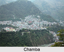
 The town of Chamba was founded in 920 by Raja Sahil Varman. It is now located in the Chamba district of Himachal Pradesh. There are 3 well defined ranges in the district- the Dhauladhar Range, the Pangi or Pir Panjal Range and the Zaskar Range. Its high mountain ranges have given it a sheltered position for over 1000 years and helped in preserving its centuries old relics and other numerous inscriptions.
History of Chamba
Chamba has an ancient history and is the only state in northern India to preserve a well-documented history from circa 500 AD. The early history of the Chamba region states that the earliest rulers of the area were the Kolian tribes, who were later subjugated by the Khasas. The Khasas too after a time came under the sway of the Audumbaras in the 2nd century BC. The Audumbaras were a north Indian tribal nation east of the Punjab, in the western Himalayan region. They were the most important tribes of the Himachal.
In the 4th century AD, during the Gupta period, the Chamba region was under the control of the Thakurs and Ranas, who considered themselves superior to the tribes of Koli and Khasas. With the rise of the Gurjara Pratiharas in the 7th century AD, the Rajput dynasty came into power. The recorded history of the Rajput rulers can be traced to an eminent individual named Maru, who migrated to north-west from Kalpagrama around 500 AD. He founded his capital in the Budhal river valley at a place called Brahmaputra, which later became known as Bharmaur. His successors continued to rule over the country from that capital city for over 300 years until Raja Sahil Varman shifted his capital from Brahmaputra to the more centrally located plateau in the lower Ravi valley. He named the town after his beloved daughter Champavati. Before Raja Sahilla Varman, the Chamba region was divided into bits and pieces of territory called Rahnu occupied by numerous Ranas and chieftains who carried on relentless warfare with each other. Raja Sahilla Verman subjugated the Ranas and unified the territory. He therefore, for better administration divided Chamba into 5 zones known as Mandlas. These Mandlas were later renamed as Wizarats. This 5 fold division of Chamba region continues till today. The Wizarats are now called Tehsils. These are Bharmour, Chamba, Bhattiyat, Churah and Pangi.
 The dynasty of Sahil Varman ruled successfully without any invasion for around a millennium, until the British gained power. The Mughal emperors like Akbar and Aurangzeb did try to annex Chamba but were unsuccessful since the isolation of the town and its rugged hilly terrain were the contributing factors to its security. Raja Prithvi Singh, who ruled Chamba from 1641 to 1664 AD, was on amiable terms with Emperor Shah Jahan and visited the royal court many times. He introduced the Mughal style of court life including the Mughal-Rajput art and architecture in Chamba.
By the last quarter of the 18th century, the Sikh army had invaded the British territory and enforced the hill states to pay tribute. But the Sikhs were defeated and a decision to merge Chamba with Jammu & Kashmir was put forth but on the timely intervention of the Wazir Bagha it was taken under the British control and subjected to the annual tribute of 12,000 rupees. On 15th April 1948 Chamba, Mandi-Suket, Sirmour and all the other state falling in Shimla hills merged together to form Old Himachal.
Demographics of Chamba
The city of Chamba is divided into 11 wards for which elections are held every 5 years. As per the report released by the Census India 2011, the Chamba Municipal Council has a total population of 19,933 of which 9,971 are males while 9,962 are females. The population of children between the ages of 0-6 years is 1864 which is 9% of the total population of Chamba. The female sex ratio is 999 against the state average of 972. When compared to the state average of 909, the child sex ratio in Chamba is 944. The literacy rate is 92% which is higher than the state average of 83&percent;. In Chamba, male literacy is around 95% and female literacy rate is 88%.
Climate of Chamba
Chamba has a warm temperate type of climate. The temperatures in summer vary between 38° C to 15° C and are rainier than the winters. The temperatures in winter are between 15° C to 0° C. The maximum temperature recorded in summer is 39° C and the minimum temperature is -1° C. The ideal time to visit Chamba is during the months of March to June. The average annual rainfall in the town is 786 mm.
Arts in Chamba
Chamba is also well noted for its arts and crafts, particularly its miniature Pahari paintings, its handicrafts and textiles. Casting metalware in Chamba is an ancient tradition, with items typically made out of copper or brass, and also irons, especially in the traditional making of implements and weapons by blacksmiths. Chamba has its own unique traditional system of men"s and women"s footwear and jewellery made in silver and gold.
Popular festivals like Minjar Mela and Suhi Mela are of great attraction here.
Places of Attraction in Chamba
Listed below are a number of places in Chamba, which are a major tourist attraction:
The Champavati Temple: Built by Raja Sahil Varman, this temple is based on the Shikhara style, with intricate stone carvings. The temple was named after the king"s daughter Champavati and is a pilgrim destination for Hindus. The temple is dedicated to Goddess Mahishashuramardini.
 Banni Mata Temple: Situated at an elevation of 8,800 feet, right at the base of Pir Panjal Range is this ancient temple dedicated to goddess Kali. The temple is named as Banni because this place has a lot of Ban trees or Oak trees. The temple and the goddesses presiding in it are both very important to Bharmour region.
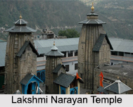
Lakshmi Narayana Temple: Built in the 10th century AD, this is the main temple of Chamba. The temple of Lakshmi Narayana continued to be embellished by the Rajas who succeeded to the throne of Chamba. Raja Balabhadra Verma perched the metallic image of Garuda on a high pillar at the main gate of the temple. Raja chhatra Singh placed gilded pinnacles on the temple tops in 1678 as a reaction against the orders of Aurangzeb to demolish the temple. Later Rajas also added a shrine or two thus enriching the complex.
Sui Mata Temple: The legend surrounding this temple is supernatural, when Raja Sahil Varman founded the town and made an aqueduct for water supply to the town, the water refused to flow. To appease the Gods, the Raja"s wife along-with her maidens sacrificed themselves and was burned alive in a grave. It is said that the grave was filled in and water began to flow. A shrine was constructed on top of the hill to commemorate her memory. There is an annual fair called Suhi Mela, where only the women and children can participate.
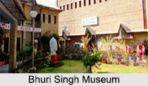
Bhuri Singh Museum: This museum houses the ancient inscriptions mainly in Sarda script, numerous artefacts and other items that were unearthed from Chamba. The former Raja Bhuri Singh donated his family"s collection of paintings to the museum, including royal portraits which ranged from Basohli to Guler-Kangra in style, and embroidered Pahari miniatures.
The other places of attraction are the Chaugan, Church of Scotland, Akhand Chandi Palace, Kalatop, Khajjiar, etc.
Visiting Information on Chamba
The nearest railway station is at Pathankot, which is 120 km from Chamba. And the Pathankot airport is at a fair distance from the town of Chamba.
