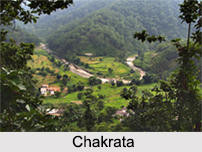
 Located in the Dehradun District of the state of Uttarakhand, Chakrata is renowned for its picturesque picnic spot. This small hamlet is located at an altitude of 7000 ft above sea level and one can view the panoramic view of the lovely Yamuna Valley and the surroundings from the hillock.
History of Chakrata
Originally known as Jaunsar Bawar, a small hamlet of the Jaunsari tribe, Chakrata Cantonment comprises of the mid-portion of this tribal area. This region was a part of a territory once ruled by Raja of Sirmaur, and later conquered by the Gorkhas. In the year 1854, the British Indian Army expelled the Gorkhas, and annexed this area. Captain Birch made the first settlement during the period of 1816-17. In the year 1866, a cantonment belonging to the British Army was set up here by Col. Hume and was occupied by the British troops in 1869. Chakrata is now a part of the Indian Army cantonment. In 1901, Chakrata Tehsil, with a collective population of 51,101, was actually a part of Dehradun District of the United Provinces, which consisted of the towns from Kalsia and Chakrata, which is most known for the rock edict of the Mauryan king Ashoka in the 2nd century BC. Currently, the place offers mesmerising sceneries to trekkers and nature lovers.
Chakrata is an access-restricted military cantonment, and foreigners face severe restrictions in visiting. Notably, it is the permanent garrison of the secretive and elite Special Frontier Force, the only ethnic Tibetan unit of the Indian Army which was raised during the Sino-India War of 1962. In Chakrata, weapons and survival training is also given by other intelligence services, in support of Indian foreign policy goals, especially pertaining to other countries in the Indian Subcontinent.
 Climate of Chakrata
The hilly cantonment of Chakrata is known for its freezing temperatures during winters and pleasant climate during summers, it has a warm temperate type of climate. The average annual temperature of Chakrata is 14.8 degree Celsius and receives an annual rainfall of 1780mm. During the summer months from March to June, the minimum average temperature is 10 degree Celsius and the maximum being 30 degree Celsius. The period between the months of December to February is the winter, when the temperature drops to below 15 degree Celsius and at times even touches as low as -5 degree Celsius. Chakrata receives heavy snowfalls during the winter season. The best season to visit is during the summer months and the months of October to November which is the autumn season.
Demographics of Chakrata
Chakrata is a Cantonment Board city and is divided into 6 wards for which elections are held every 5 years. The Chakrata Cantonment Board has population of 5,117 of which 3,717 are males while 1,400 are females as per report released by Census India 2011. The population of children under the ages of 0 to 6 years old is 7.17 percent and the child sex ratio is around 844 compared to Uttarakhand state average of 890. Literacy rate of Chakrata city is 90.38 percent higher than state average of 78.82 percent. In Chakrata, Male literacy is around 94.31 percent while female literacy rate is 79.14 percent.
Tourism of Chakrata
The picturesque small town of Chakrata is surrounded by the rhododendrons and oak trees forests, which provides one of the best views of the Garhwal Mountains in the region thus, making it a perfect gateway for the tourists. Listed below are some of the popular tourist attractions of Chakrata.
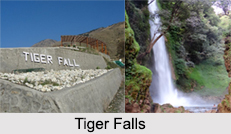
Tiger Falls: It is one of the highest direct waterfalls in Uttarakhand and can be reached via a small trek through the forest. The Tiger Falls is 20 km from Chakrata and has an elevation of 312 ft.
Budher: Also known as Moila Danda is a picturesque meadow at an altitude of 2800 m. The Karst landscapes of Budher are home to a network of ancient limestone caves.
 Kanasar: It is surrounded by one of the famous Deodar forest of Asia. About 25 km from Chakrata market on Tuini Road, which are not in the best shape. The meadows and giant trees more than make up for the bumpy drive. It is one of the best picnic spots near Chakrata. A forest rest house in Kanasar and some tented accommodation allows visitors to spend a night here on prior booking.
Chilmiri: A sunset point at 4 km from main Chakrata market is a picturesque plateau offering one of the best views of the setting sun.
Lakhamandal: It is an ancient Hindu temple complex dedicated to Lord Shiva and is associated with the Pandavas. It is slightly further from Chakrata and may take almost a whole day of driving and coming back. The temple is popular among the Shakti Cult, who believes that a visit to this temple shrine will end their misfortunes. This site is under the domain of the Archaeological Survey of India.
Manjhgaon: Another ancient Hindu temple dedicated to Lord Shiva and is known in the regional language as Massu Devta. It is at a distance of 15 km from the Chakrata market. It is one of the very oldest temples in the region.
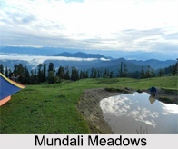
Other places of attraction in the area is the Mundali meadows, which are difficult to access but offers exciting winter sports and then there is Deoban, which is surrounded by dense forests and is perched at about 2900 m offering the panoramic view of the Himalayas.
Visiting Information of Chakrata
The small hill station of Chakrata does not have a railway station or an airport, the only way to reach Chakrata is via roadways. There are two main railheads which are closest to Chakrata, one is at Dehdradun at a distance of 92 km and the other at Saharanpur at a distance of 125 km. The Jolly Grant Airport of Dehdradun is the nearest at a distance of about 115 km from the hill station of Chakrata.


