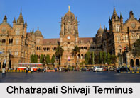
 Central Railway Zone of India is one of the largest Indian railway zones. There are 16 zones of Indian Railway carrying passengers all across the nation. The Central Railway is headquartered in Mumbai at the Chhatrapati Shivaji Terminus (CST), which was formerly known as the "Victoria Terminus". As India"s first passenger railway line, the Central Railway was inaugurated on 16th of April, 1853. It stretched from Bombay (presently, Mumbai) to Thane at the time. Presently, the railway covers a major portion of Maharashtra and some regions of southern Madhya Pradesh and north-eastern Karnataka.
Historical Development of Central Railway Zone of India
Central Railway Zone of India started functioning from 5th of November, 1951. It initially comprised of various government-owned railways like the Scindia State Railway of Gwalior and the Great Indian Peninsula Railway. Formerly, the Central Railway Zone comprised of large portions of Madhya Pradesh and part of southern Uttar Pradesh. This made it the largest railway zone in the country in regards to staff, area as well as track mileage. In April 2003, these areas were included under the West Central Railway Zone.
At the initial stage of the development of Central Railway, it extended for about 34kilometers from Boree Bunder (presently, Chhatrapati Shivaji Terminus) to Tannah (presently, Thane). Central Railway`s first ever train to run on Indian soil changed the history of India. Central Railway marked the dawn of the Railway Age in Asia. After about a year, the railway line was extended from Thane to Kalyan (20 kilometers). From Kalyan, the central railway line branched into two directions, namely the North Eastern Line leading towards Igatpuri and Bhusaval and the South Eastern Line leading towards Pune and Solapur. The period from 1861 to 1870 was very important for Central Railway Zone of India. This is because the fast growing industrial town of Mumbai was connected with Calcutta (presently, Kolkata), during the period. In the same decade, Bombay got connected with Madras (presently, Chennai) and with Nagpur.
 In the present decade, Central Railway is a network of about 3905.47 route kilometres, and about 5818 track kilometres, linking about 477 stations over 5 divisions. Mumbai suburban train system is the lifeline of Mumbai, a metropolitan city in India, where about 3 million commuters travel every day in about 1236 local trains, serving about 73 stations.
Divisions of Central Railway Zone of India
Central Railway Zone of India has been classified into particular divisions, namely the Mumbai Division, Bhusawal Division, Nagpur Division, Solapur Division and Pune Division. Various Indian railway stations come under the respective divisions. The Mumbai Division was created in 1888 and there are about 102 railway stations under this division. The Bhusawal Division has about 15 railway stations. The Nagpur Division was created in 1867 and there are about 92 railway stations under this division. The Solapur Division is the largest division of central railway and there are about 96 railway stations under this division. The Pune Division was created in 1996 and there are about 71 railway stations under this division.
Routes of Central Railway Zone of India
Routes of Central Railway Zone of India comprise of main or long routes and short or branch routes. Mumbai CST - Kalyan -Kasara - Manmad - Jalgaon - Bhusawal - Akola - Wardha - Nagpur, Pune - Daund - Solapur - Wadi - Tandur and Pune - Satara - Sangli - Miraj - Kolhapur are three main or long routes of Central Railway. Daund-Manmad, Thane-Vashi and Bhusawal-Khandwa are three short or branch routes of Central Railway.
Trains of Central Railway Zone of India
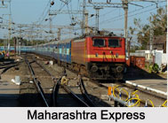
Some of the notable trains of Central Railway Zone of India are Deccan Queen (running between Pune and Mumbai), Maharastra Express (running between Gondia and Kolhapur), Pushpak Express (running between Lucknow and Mumbai), Vidarbha Express (running between Mumbai and Nagpur), Konark Express (running between Bhubaneshwar and Mumbai), Gitanjali Express (running between Mumbai and Howrah), Azad Hind Express (running between Howrah Junction and Pune Junction) Hussainsagar Express (running between Hyderabad Deccan and Mumbai CST), Punjab Mail (running between Mumbai CST and Ferozpur) and Kurla Express. Central Railway also runs about 40 suburban trains in the Pune-Lonavla section.
Significance of Central Railway Zone of India
Significance of Central Railway Zone of India relates to its contribution in the progress of the nation. Central Railway acts as a carrier of passenger and cargo traffic. The railway has become a premier passenger carrying system amongst all Indian Railways. It carries more than 4 lakh passengers daily to every nook and corner of the country through about 548 mails, express trains and passenger trains.


