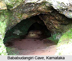
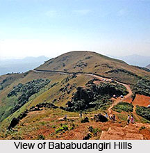
 Cave Structure of Bababudangiri, located in Chikmagalur District in the southern Indian state of Karnataka includes a holy shrine which has been named after `Dattatreya`, an incarnation of the Divine Trinity: Lord Vishnu, Lord Brahma and Lord Shiva or Maheshwara. This avatar`s appearance resembles that of a sage of `Avadhuutha` or a monk intoxicated by the powers of God. Baba Budan, a famous Sufi saint is believed to have been a resident of this cave shrine for some time. The cave is managed by Muslims though Hindus are also known to have made claims on this holy place which has fuelled communal disharmony between these two religious communities. During `Urs` which commemorates the death anniversary of this Sufi saint and also `Datta Jayanti`, fierce communal riots occur in the Bababudangiri Cave which are observed in December. The Shobha Yatras conducted by the Hindus in this sacred spot gave rise to frequent religious conflicts here. As per the verdict of the Supreme Court of India, only those religious ceremonies can be practised in Bababudangiri Cave which used to be performed before the year 1975. Since Shobha Yatra was never practised prior to the year 1975, the policemen have not permitted buses to reach Bababudangiri during Datta Jayanti.
Bababudangiri signifies a combination of the diverse cultures of Muslims and Hindus and both such communities offer their prayers in this cave structure. It is said that this Indian cave has obtained its present name from a Sufi saint who was a follower of yet another Sufi saint known as Hazrath Dada Hayath Meer Khalandar who had approached India during 1005 AD in order to preach Sufism in the country, all the way from West Asia.
 He had chosen this particular cave for practising meditation when he arrived in southern India and the Puranic term of the hills was `Chandra Drona` since it was similar to a horse-shoe or a crescent. The place selected by Dada Hayath Meer Khalandar was also the exact holy spot which was said to be the abode of Dattatreya Swamy, the last avatar of Lord Vishnu who had disappeared from these caves to Kashi for further reincarnations.
According to yet another opinion, Dattaraya Swamy and Dada Khalandar are the same person. There is a legend which states that once Dada had cleaned this region as he wanted to indulge in deep meditation and required water for performing ritual of `wazu` for his prayers. Since he was new to the place he had no knowledge of water and began digging the place in front of which he had chosen his meditation spot. He then discovered a perennial spring after which he expressed his gratitude to God. Following this, he started praying and meditating. A `jangama` and a Brahmin reached this cave the next morning and thought that Dada, who was absorbed in meditation, was none other than Dattatreya Swamy. On the other hand the Muslims are also of the view that Dada had vanished from the Bababudangiri Caves and travelled to Madina and Mecca and is still alive. Muslims feel he would soon appear in front of his followers. His holy mission was further carried forward by Baba Budan who is said to have brought coffee to this hilly area, from Mocha in western Asia.
Baba Budan`s origin can be dated back to the area called Baghdad who had approached Chikmagalur via Mangalore and Malabar. Baba Budan was murdered in an ambush close to the Bababudangiri Cave and was buried right here with two other Sufi saints. Baba Budan was also popularly referred to as Jan-e-Pak Shaheed and Hazrath Syed Meran Baba. Another saint by the name of Hazrat Syed Shah Jamaluddin is also associated with Bababudangiri. Sajjade Nishin is the official superintendent of this cave.


