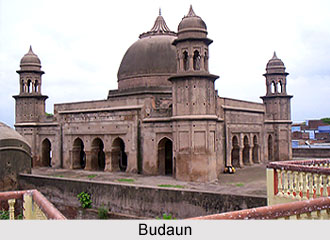
 Budaun is considered as the holy land of saints and Sufis. River Ganga flows by the district. Budaun has an agrarian economy and it trades in grain, cotton, sugarcane, and oilseed. Earlier it was an important military outpost under the Mughals.
Demographics of Budaun
According to 2011 census Badaun City has area of 73 sq. km whereas the Budaun Urban area is spread over in 98 sq. km. Budaun Urban Area includes Budaun City and adjoining Naushdra, Kheda Nawada, Sheikpur, Panchkuli and Baheri. Budaun city has a population of 490,000. Males constitute 53% of the population and females 47%. The City has an average literacy rate of 93%, higher than the national average of 74.
History of Budaun
According to the Encyclopedia of 1911 Buduan is a town and district of British India, in the Rohilkhand division. The first authentic historical event connected with it was its capture by Qutb-ud-din Aybak in 1196. After this it became an important post on the northern frontier of the Delhi Empire. The town was burned in 1571. Under Shah Jahan, the seat of the governorship was transferred to Sahaspur- Bilari.
Infrastructure in Budaun
Budaun is the sixth most developing city of Uttar Pradesh. There are several degree colleges, other institutions, hospitals and market. There are several banks with its multiple branches.
Historical places in Budaun
Jama Masjid( Built in 1223 A.D. by Illtutmish), Badaun fort in Jawaharpuri.
Hazrat Khwaja Nizamuddin Auliya`s house in Syedwada, Choti Ziyarat(monument of Hazrat Badrauddin Rahmatullah Alhay), Badi Ziyarat (Dargah `mazar sariff` of Wali of Allah, Hazrat Sultan Arfiin Rahamtullah), remains of Sheikhupur Fort, Mumtaz Mahal`s sister`s mausoleum, Sheikhupur and ruins of many mughal monuments are the historical places in Budaun.
