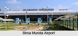
 Birsa Munda Airport (BMA) is regarded a public domestic airport that serves the city of Ranchi, Jharkhand, India. The airport is managed by the Airports Authority of India (AAI). Birsa Munda Airport is sited in the Hinoo locality, 7 km from the centre of the city. It is the 27th busiest airport in India. It is also famous as Ranchi airport. In terms of service the Birsa Munda Airport can easily be recognised as a small airport. But recently with massive growth of air traffic in India, the Birsa Munda Airport has gone through unexampled growth in the last 2 years. Many budget airlines have also added the destination to their routes. Hatia Railway station is located at a distance of a kilometer from Birsa Munda Airport.
Travelers can get various flights to other cities such as Mumbai, Kolkata, Patna and others. Approximately 500 domestic passengers can travel from this airport. Indian Airlines, Jet Airways and Kingfisher Airlines are some of the airlines which offer budget flights.
Infrastructure of Birsa Munda Airport
Birsa Munda Airport spans over 2 sqkm. There is only one runway, parallel to the airport"s main terminal area.
Initiatives for Developing Birsa Munda Airport
According to a record of Airport Authority of India, around 200,000 passengers use the airport every year in order to make it one of the fastest growing airports in the country. In the recent past, the government had sanctioned plans to expand the airport. They have plans to construct an additional runway, a new terminal, few additional taxiways and also to provide better passenger facilities. Air Deccan; Air Sahara; Indian are the airlines that touchdown the Birsa Munda Airport. Other airlines have also planned to cater to the airport. The airport recently got aerobridges in departure side. Hajj pilgrims from Bihar, Jharkhand annually go Jeddah from this airport. For this Air India arrange special flights in September to October daily. Airport is also trying to connect Bokaro, Jamshedpur by a regular bus service directly from airport.
A new larger, Integrated Terminal with facilities for customs and immigration, duty-free shops, travel desks, lounges, etc. was inaugurated on 24 March 2013. The tax on ATF was reduced from 20% to 4% to attract more airlines to the city. Also, night landing at Birsa Munda Airport has been made free so that there may be more flights to the metro cities in the morning. The Airports Authority of India also announced the construction of three more parking bays, thereby making it the first Tier-II airport in India to have 8 planned parking bays.
Facilities at Ranchi Airport
This airport is one of the fastest growing airports where large number of passengers visit.
•Baggage Services: Free baggage services are available for visitors, so that they can easily carry their luggage to terminal. Airport is well matched with baggage checking system which protects the luggage of the travelers.
•Places to Shop and Eat: Ranchi airport facilitates passengers with many shops from where you can one food and beverages easily. Food is affordable while waiting for flight.
•Duty Free Shopping: Duty Free Shops are available for travelers. This airport is growing very fast and equipped with latest and advanced facilities. Many shops offer products without any tax.
Accident at Birsa Munda Airport
On 9 May 2012, a helicopter departed from Birsa Munda Airport to Kuchai Helipad, carrying the then Chief Minister of Jharkhand, Arjun Munda, crashed on the airport while executing an emergency landing after the helicopter developed problems with rudder control and returned back to Birsa Munda Airport. All passengers and crew survived.
Connectivity with the City
Airport is centrally located from where one can take any of the public transport to reach Ranchi bus stand. Ranchi Railway Station is 6 km far from the airport. Railway Station is well connected with various cities as you can easily get many trains. New Delhi, Chennai, Mumbai, Kolkata, Bengaluru are some of the major cities which are connected by trains.


