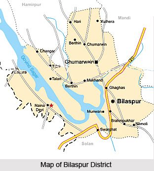
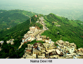
 Bilaspur District is one of the 12 administrative districts of Himachal Pradesh with its headquarters located at Bilaspur. It is situated in the Sutlej valley in the outer hills and covers an area of 1,167 sq kms. Its boundaries touch Una District, Hamirpur District, Mandi District and Solan District. Sutlej River is the main river which passes through the middle of the district and divides it into almost equal parts. The New Township Bilaspur is regarded as the first planned hill town of the country.
Bilaspur District lies between 31 degree 12 minutes 30 seconds and 31 degree 35 minutes 45 seconds north latitude and between 76 degree 23 minutes 45 seconds and 76 degree 55 minutes 40 seconds east longitude. It lies in the outer hills of the Himalayas next to Punjab plains and forms a part of the basin of River Sutlej which flows meandering across it for about ninety kms. It is bounded on the north by Mandi and Hamirpur districts, on the west by Hamirpur and Una districts, on its south lies Solan district. It is encircled in the east and north-east by Solan and Mandi district.
History of Bilaspur District
According to the early history of Bilaspur District, this region was ruled by the Chandravanshi Rajputs. After the independence of the country, Himachal Pradesh came into existence on 15th of April, 1948. It was created by merging 30 Punjab and Shimla Hill states in the Indian Union. At the time of the formation of this state, it had four districts - Chamba, Mahasu, Mandi and Sirmaur. Bilaspur was formed a separate district of Himachal Pradesh on 1st July, 1954.
 Geography of Bilaspur District
Bilaspur district is situated in the Sub-mountain and low hills sub-tropical zone of Himachal Pradesh. There are seven hill ranges in the district namely Naina Devi, Kot, Jhanjiar, Tiun, Bandala, Bahadurpur and Rattanpur. Majority of these constitutes a chaugan agro-ecological situation of the district. Maximum length of Bilaspur District from east to west is about 51 km and maximum width from north to south is about 43 km. The district is mostly hilly and elevation of the lowest point is about 290 metres and that of the highest is about 1980 metres. The climate of Bilaspur District is temperate to sub-tropical. The summers are invariably hot, temperature rising to 42 degree Celsius at some places and it falls down to 30 degree Celsius soon after monsoons. For about three months in winter a thick mist surround Sutlej. Winters start around October and reach its peak in December-January. Average annual rainfall is around 1478.8 mm. The district receives maximum rainfall in the rainy season that is between June and August which is about 70 percent of total. During July and August relative humidity is very high in the district, which favours the infestation of insect pests and diseases in different crops. Best months for visiting this place are from September to December.
Culture of Bilaspur District
Fair and festivals are interwoven in the daily lives of the people of Bilaspur District. It is rather a cultural heritage of the people. Various types of fairs and festivals are celebrated almost throughout the year.
Tourism in Bilaspur District
Bilaspur District offers several ancient sites for exploring. Sunhani (a very attractive and historical place of Bilaspur District), Auhar (a significant town situated in the middle of the district), Fort of Kotkahlur, Fort of Bahadurpur, Fort of Sariun, Fort of Tiun, Fort of Bachhretu, Bhakra Dam, Gobind Sagar Lake, Kandrour Bridge, Deoli Fish Farm, Namhol, Kol Dam, Swarghat, Badol Devi temple, Laxmi Narayan Mandir and Vyas Gufa are some of the main attractions of Bilaspur District. These places are worth visiting.
There are two National high ways passing through Bilaspur District (Chandigarh-Manali, Kangra - Shimla via Jhukhala). Shimla, Chandigarh and Bhuntar are the nearest airports, located at 85 kms, 135 kms and 131 kms from Bilaspur. The nearest broad gauge railway station is at Kiratpur Sahib and nearest narrow gauge railway station is at Shimla, located at 65 kms and 85 kms from Bilaspur which are connected by regular bus services. Bilaspur is easily approachable by road from Shimla and Chandigarh.


