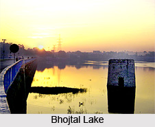
 Bhojtal Lake, formerly known as Upper Lake, is located in Bhopal (Madhya Pradesh). This lake is situated on the western side of the capital city of Madhya Pradesh. The Capital City of Madhya Pardesh is Bhopal.
Bhojtal Lake serves as a major source of drinking water for the residents of the Bhopal city. This lake is serving around 40 percent of the inhabitants of Bhopal.
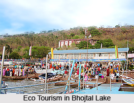
"Bada talaab", a locally known lake with fresh and sweet water, along with the nearby "Chhota Talaab" are the eco tourism spots in Bhopal. This aquatic region is known as Bhoj Wetland.
Location of Bhojtal Lake
Bhojtal Lake is situated on the west central part of Bhopal city of Madhya Pradesh. This artificial lake is surrounded by Van Vihar National Park on the south, the urban settlements on the east and north, and agriculture fields on the west. Bhojtal Lake has an area of 31 square kilometres and drains a catchment or watershed of 361 square kilometres. The watershed of the Bhojtal Lake is mostly rural, with some urbanized areas around its eastern part of the lake. Kolans River was formerly a tributary of the Halali River. But with the creation of the lake using an earthen dam and a diversion channel, the upper reach of the Kolans River and "Bada Talaab" now drains into the Kaliasote River. This lake is termed as the largest artificial lake in Asia.
History of Bhojtal Lake
A fresh water lake, Bhojtal Lake was butilt by Raja Bhoj of Paramara Dynasty. During his tenure as a king of Malwa (1005-1055), he built that lake for the self and for the development of the inhabitants of that time. Raja Bhoj of Paramara Dynasty is also said to have established the city of Bhopal to secure the eastern frontier of his kingdom. There is a legend behind the Formation of the Lake. This legend was made as folklore.
 Legend of Bhojtal Lake
This medieval king Bhoj of Paramara suffered from skin disease. At that time all the doctors failed to cure him. Then, one day, a saint told the king to build a tank to combine 365 tributaries and then have a bath in it to wipe out the skin disease. Raja Bhoj ordered to build up a huge tank. They spotted a place near Betwa River, which was 32 kilometers away from Bhopal. It was found that it has only 355 tributaries. A tribal commander of Gond dynasty, Kalia fulfilled this shortage. He then gave the address of an invisible river. After merging the tributaries of this river the number 365 was completed.
Bhojtal Lake in Modern Time
Bhojtal Lake was created by constructing an earthen dam across the Kolans River. An eleven gate dam called the Bhadbhada dam was constructed at Bhadbhada in the year 1965 at the southeast corner of the Bhojtal Lake, and now controls the outflow to the Kaliasote River. The lake was known as the Upper Lake or Bada Talab until March 2011. It was renamed to Bhoj-taal in honour of the Great King Raja Bhoj of Paramara Dynasty who built it.
Flora and Fauna in Bhojtal Lake
A wet land in Bhopal and the largest artificial lake in Asia, Bhojtal Lake consists of a large number of aquatic flora and fauna. There are about 105 species of zooplanktons, which includes Rotifera, Protozoa, Cladocera, Copepoda, Ostracoda, Coleoptera, and Diptera. The fish fauna consist of 43 genuses. Some of the species are of natural and cultured. There are about 27 species of avifauna, 98 species of insects and more than 10 species of Reptiles and Amphibians have been recorded.


