 Bhiwani District is one of the administrative districts of Haryana. This district was created on 22nd of July, 1972. Bhiwani town is the district headquarters. Bhiwani District is situated between 28 degree 19 minutes and 29 degree 5 minutes north latitude and 75 degree 26 minutes and 76 degree 28 minutes east longitude. Bhiwani District is surrounded by Hisar District on its north, some area of Jhunjhunu District and Churu District of Rajasthan on its west, Mahendragarh and Jhunjhunu districts on its south and Rohtak District on its east. It is 124 kms from Delhi and 285 kms from Chandigarh. Total area covered by Bhiwani District is 5,099 sq kms.
Geography of Bhiwani District
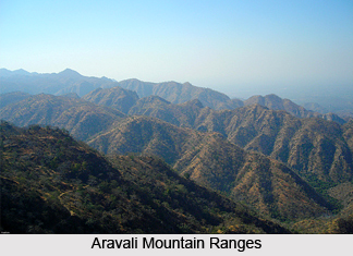
In the north region of Bhiwani District there are alluvial plains and the district`s southern portion is semi-desert with remnants of Aravali Mountain Ranges. The soil is loom in the north region and sandy in the south-west region of Bhiwani District. Groundwater is mainly saline with some of small pockets of fresh water in the south-west. The groundwater level of the district is decreasing alarmingly. Moreover, lack of proper drainage system is the main cause of salinity of ground water. Its climate is dry and area is desert like due to the fact that it falls on the border of Rajasthan.
 Temperature here varies from 2 degree Celsius to 45 degree Celsius. Annual average rainfall in Bhiwani District is 483 mm. this district receives maximum rainfall mainly in the months of July to August. Minerals like Building Stone and Gypsum or flexible stones are the main minerals found in the district.
Administration of Bhiwani District
Administration of Bhiwani District has five sub-divisions namely Bhiwani, Dadri, Loharu, Tosham and Siwani. The tehsils of Bhiwani District are Bhiwani, Dadri, Loharu, Tosham, Siwani, Badhra and Bawani Khera. Administrative set-up of Bhiwani District also has development blocks and these are Bhiwani, Dadri (I), Dadri (II), Loharu, Bawani Khera, Badhra, Tosham, Siwani, Kairu and Behal.
Economy of Bhiwani District
Economy of Bhiwani District is mainly agrarian in character as the major source of occupation here is agriculture. Apart from agriculture some other medium scale and small scale industries are providing employment to the people of the district. Most of the land here is used for cultivation. So, in villages the main source of income is agriculture and allied activities. Bajra, cotton, wheat and mustard are mainly cultivated here.
Bhiwani is well connected with the other major cities of the district through roadways and railways. By road, the district is connected to cities like Rohtak, Delhi, Pilani, Jaipur, Hisar, Sirsa, and Chandigarh. By Rail it is connected to Delhi, Mathura, Malda, Jaipur, Ferozepur, Chandigarh, Amritsar, Hisar and more cities.


