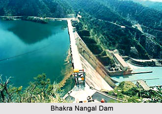
 The Bhakra Nangal Dam is the largest dam in the continent of Asia and it is located across Sutlej River at the foot of the Sihvalik Hills in the border of Punjab and Himachal Pradesh. The dam measures 518.25 meters in length and 304.84 meters in breadth. It is also the biggest multi-purpose project in India the construction of which started in 1948 and was completed by 1968. Punjab, Haryana and Rajasthan had jointly launched this project. The Bhakra Nangal Dam is also known as the highest gravity dam in the world.
The construction of the Bhakra Nangal Dam dates back to the time when India was not yet an independent nation. This dam is known as the New Temple of Resurgent India and was dedicated to the nation by Jawaharlal Nehru, the First Prime Minister of India in the year 1963.
The main purpose behind the construction of the dam was to provide irrigation to the states of Punjab and Himachal Pradesh. Another major reason behind the construction of the dam was to prevent damages which were caused due to the monsoon floods. Presently, the dam provides irrigation water to an area of around 10 million acres. The irrigated areas by the dam comprise fields of Punjab, Haryana, Himachal Pradesh, Rajasthan and Delhi. Another important use of the dam is to provide hydro electricity to the states of Himachal Pradesh, Delhi, Punjab and Haryana.
As far as tourist attraction is concerned, the Bhakra Nangal Dam serves as an important tourist destination. Being located amidst the lush greenery of Himachal Pradesh a large number of tourists flock the dam area throughout the year. In order to promote tourism in the dam area the government of Himachal Pradesh has arranged for a number of rest houses which accommodates many of the tourists who visit the place. The natural water fall near the dam is an added attraction. The natural water fall generates hydro electric power through the power stations of Ganguwal and Kotla.
An important feature of the Bhakra Dam is its large reservoir which is known as the Gobind Sagar Reservoir. The reservoir has a capacity to store around 9340 million cu meters of water which is enough to drain the entire Chandigarh, parts of Haryana, Punjab and Delhi. Gobind Sagar is one of the world"s highest gravity dams, which rises nearly 225.5 meter above its lowest foundations. Harvey Slocum, the American dam-builder supervised the construction of the Bhakra Dam. The construction work had begun in the year of 1955 and was completed in 1962. The flow of Beas River was channelized to Gobind Sagar by the Beas-Sutlej link in order to maintain the level of water. This Beas to Gobind Sagar channel was completed in 1976.
The Gobind Sagar reservoir lies in between the Bilaspur District and Una. Bilaspur lies about 83 kilometers away from the railway station at Anandpur Sahib, which is very close to the Bhakra Nangal Dam. When the water level of the reservoir is high in the months of October and November, the Tourism and Civil Aviation department organises a series of regattas. Water-skiing, sailing, kayaking and water scooter racing are popular water sports activities enjoyed by the tourists visiting Gobind Sagar.
In 1962 the Gobind Sagar Dam was declared as a waterfowl refuge. Fishing is commonly practiced in this reservoir. There are about fifty-one species and sub species. Labeo dero, Tor pitutrata, Mystus seenghala and Mirror carp are some of the widespread species found in Gobind Sagar Dam. Major attractions of the lake are ferry rides and water sports like speed boating, pulling crowds which keep the lake area forever busy.


