Bengaluru Rural District is situated in the state of Karnataka. It came into existence in the year 1986 after the division of the erstwhile Bengaluru district into two separate districts of Bengaluru urban and Bengaluru rural district. Lying in the South Western corner of Karnataka state, it is primarily an agricultural area and dry farming is a characteristic feature of this district. Situated in the beautiful Arkavati River Valley, there are a number of famous tourist spots in the district, such as Mekedaatu, Sawan Durga, etc. The district is famous for the lacquer ware works of Channapatna. The new district physically almost surrounds the Bengaluru (Urban) District except having an opening in the South-East, the Anakal Taluk, the connecting area between Kanakapura and Hosakote Taluks, being a part of the Bengaluru (urban) district and the headquarters of the new district is at Bengaluru itself. Bengaluru Rural District is bounded on the North by Tumkur and Kolar District; on the South by Mandya and Mysore Districts and Tamil Nadu State; on the east by Kolar District and Tamil Nadu State and on the West by Tumkur and Mandya Districts
History of Bengaluru Rural District
Historically, the earliest dynasty which established its sway over this district is that of the Gangas. In about the fourth century A.D., the Ganga dynasty was established at Kolar and the territory comprised in Bengaluru Rural district formed part of Gangavadi. Honganur of Channapatna Taluk was the chief town of a sub-division, called Chikka Gangavadi, which occupied the Shimsha valley. During the Seventh century, Mankund was a place of great importance and was the second royal residence of Ganga Bhuvikrama (654-79) and also of Shivamara (679-726). In the eight century Shri Purusha made Manyapura (Manne of Nelamangala Taluk) his royal residence and later it was a major centre under the Rashtrakutas. Manne had been the headquarters of Rashtrakutas Governor Kambarasa. Certain parts of the district, especially in the East, were held by the Nolamb Pallavas.
Geography of Bengaluru Rural District
Bengaluru Rural District is located in the South-Eastern corner of Karnataka State. Spanning a geographical area of 5,814 sq km, the district lies stretched between the latitudinal parallels of 12 degrees 15 minutes North and 13 degrees 35 minutes North on the one hand and the longitudinal meridians of 77 degrees 5 minutes East and 78 degrees East on the other.
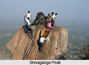
 The district, lying on the plateau with an average elevation of 600 to 900 metres from mean sea level, has ranges of hills which are actually spurs of the Eastern Ghats mountain range stretching northwards with peaks like the Banantimari Betta, Mudawadi Betta, Bilikal Betta, Siddadevara Betta, etc. The Savandurga and Shivaganga peaks are another row of hill ranges, spreading upto the Nandi Hill running across the Bengaluru (Urban) district. The major portion of Bengaluru rural district lies in the Arkavati valley. The Arkavati, the Kanva River and the Dakshina pinakini (southern Pennar River) are the rivers which flow through the district in the general direction from north to south. Bengaluru Rural District is located in the south-eastern corner of Karnataka spanning a geographical area of 5,814 sq.km and it forms about 3.02 percent of the total area of the state. Cultivable lands are mainly rain-fed and dry farming is a characteristic feature of the district. By and large this rural district is agricultural and Ragi is the main crop though mulberry is raised over considerable tracts. The climate of the region is moderate and is devoid of extremes. But rainfall is meagre, and as no major river flows in the district, irrigation facilities are also limited.
Education of Bengaluru Rural District
The proximity of Bengaluru rural district to the state capital has not influenced favourably the educational levels in the district. The district educational profile reflects the complex socio-economic factors affecting education. The district is economically backward and it comprises of eight blocks.
Economy of Bengaluru Rural District
Cultivable lands are mainly rain-fed and dry farming is a characteristic feature of the district. By and large this rural district is agricultural and ragi is the main crop though mulberry is raised over considerable tracts. Agriculture forms the main occupation of the people of the district. Bee keeping is a major rural industry here in the various taluks, and this industry is based on agriculture, forestry and horticulture. Fisheries has gained a lot of importance and play a significant role in the economy of the country- as a good source of foreign exchange, a wholesome source of healthy protein and in providing a wide source of employment opportunities to several millions who are solely dependent on fisheries. Sericulture is an important rural, agriculture-based cottage industry. Sericulture has a standing of more than two centuries in the state and has contributed to the improvement of economic status of people. This industry is an agriculture-based industry and consists of activities like mulberry cultivation, silkworm rearing, silk reeling, twisting, weaving.
Tourism of Bengaluru Rural District
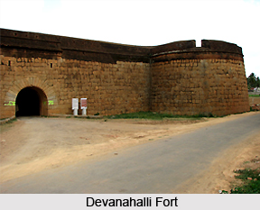
There are a number of places of tourist interest located here. These include places of historical interest such as the as the Devanahalli fort and Sawan Durga, as well as places where one can relax and soak in the beauty of nature, such as Mekedaatu, Manchina Bele etc. Channapatna in the Bengaluru district is famous for its lacquerware work. Lacquerware products include brightly coloured wooden toys, door curtains, powder boxes and napkin rings, besides a range of distinctive jewellery. These are a speciality of the Bengaluru district and a must see when on a trip here.


