 Begusarai District occupies a central position in North Bihar. It is one among the thirty eight districts of Bihar. In 1870, it was established as a sub-division of the Munger district. It emerged as a district in 1972 and was named after "Begu" a man of this district who used to look after "Sarai" an old and small market. Begusarai Town is the Districts headquarters. Begusarai District is well connected to other parts of Bihar and India through railways as well as roads.
Geography of Begusarai District
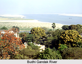
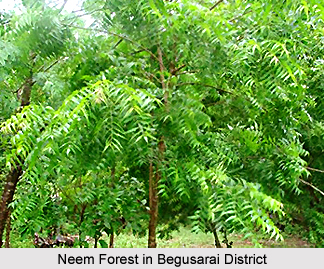
Begusarai lies in North Bihar between latitudes 25 degrees 15 minutes and 25 degrees 45 minutes north and longitudes 85 degrees 45 minutes and 86 degrees 36 minutes east. Samastipur District, bound the district on the north on the south by the Ganga River and the Lakhisarai district, on the east by Khagaria District and Munger District and on the west by the Samastipur and Patna districts. It covers an area of 1918 square kilometres. The main rivers of Begusarai District of Bihar are Ganga River, Budhi Gandak River, Bagmati River and Balan River. Besides these, there are several other small rivulets all around the district. With regard to the flora and fauna of Begusarai district, it can be said that the district does not comprise any forest. The main trees that are found in the region are Shisham, Babul, Neem Tree, Guava, Lemon, Gamahar, Pipal, Bamboo and shirish.
Wild animals are scarcely found in the district of Begusarai. However, birds are seen in large numbers in various colours, particularly in the bird sanctuary of Kaver Lake.
Administration of Begusarai District
The district of Begusarai has been divided into five sub-divisions namely Begusarai, Teghara, Balia Manjhaul and Bakhri. There are 18 blocks in the district. They are Begusarai, Mattihani, Teghra, Samho, Bachhwara, Barauni, Bhagwanpur, Balia, Sahibpur Kamal, CheriaBariarpur, Khudabandpur, Bakhari, Mansurchak, Birpur, Dandari, Nawkothi, Garhpura and Chhaurahi.

Demography of Begusarai District
According to the Population Census in the year 2011, Begusarai district has a total population of 2,954,367. According to the population, this district counts 128th in India.
The district has a population density of 1,540 inhabitants per square kilometre. Its population growth rate over the decade 2001-2011 was 25.75 percent. Begusarai District has a sex ratio of 894 females for every 1000 males. The literacy rate of Begusarai district is 0.23%.
Economy of Begusarai District
Agriculture is the main occupation for the people of Begusarai. 88.33 percent people depend upon agriculture. Main cash crops of the district are oilseeds, tobacco, jute, potato, red chilies, tomato and andi. The traditional occupation in this area has been the rearing of milch cattle. Animals are used in agricultural work even today. In urban areas rearing of cows of hybrid quality has increased. Despite domestic use of milk, a huge quantity of milk is sold to the Barauni Milk Composite Dairy Industry. This gives lucrative income and employment to the people of Begusarai.
Begusarai is nationally and internationally known for its industrial recognition. Major industrial units are Indian Oil Refinery- Barauni, and Hindustan Fertilizer Limited -Barauni, Thermal power station- Barauni and hundreds of small industrial units in the private sector in which Hindustan Fertilizer Limited -Barauni is on the verge of closure.
The district of Begusarai has potential for agro- based industries because of large production of maize and oilseeds


