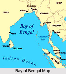
 Bay of Bengal lies in the north eastern part of the Indian Ocean. It is in fact a triangular shaped salt-water sea. The bay is surrounded by the Malay Peninsula on the east, and by the Indian subcontinent on the west. The northern section of the bay borders the Bengal region, comprising the Indian state of West Bengal and the country of Bangladesh. As it surrounds the Bengal region, the bay has derived the name Bay of Bengal. The southern tips margin the island country of Sri Lanka, and the Indian Union Territory of the Andaman and Nicobar Islands. Many large rivers including Godavari, Krishna, Kaveri, Ganga and Brahmaputra flow into it.
Climate of Bay of Bengal
The monsoon currents regulate the climate of the Bay of Bengal and the regions around it. During the months of January to October, the current flows towards the north in a clockwise circulation pattern and is called the East Indian Current. The Bay of Bengal monsoon moves in a northwest direction hitting the Andaman and Nicobar Islands at the end of May and then the North Eastern Coast of India by the end of June. Throughout the remaining part of the year, a counter-clockwise current flows towards the southwest direction, and is called the East Indian Winter Jet. During the months of September and December the weather is very active. The monsoon season often brings in severe cyclones, which affect Eastern India as well as parts of other countries. The 1971 Orissa cyclone is one of the worst.

Rivers of Bay of Bengal
The Bay of Bengal spreads over an area of 2,172,000 sq km. Many large rivers like the Ganges, the Brahmaputra, the Irrawaddy, the Godavari, the Mahanadi, the Krishna and the Kaveri drain their water into the Bay of Bengal. The shortest river, which flows into the bay, is the Cooum River. It has a length of 64 km. The Sundarban mangrove forest lies at the delta of the Ganga, Brahmaputra and Meghna rivers on the Bay of Bengal. The Ayeyarwady River of Myanmar also drains its water into the bay.
Sea Ports and Islands on Bay of Bengal
The significant ports include, Kolkata, Cuddalore, Kakinada, Vizag, Machlipatnam, Chennai, Paradip and Vishakapatnam. There are also many islands in the Bay of Bengal. The important ones are the Andaman, Nicobar and the Mergui groups of islands. Great Andaman is the chief archipelago of the Andaman Islands, whereas another group of islands, called the Ritchie`s Archipelago, is made up of much smaller islands. Out of the 572 islands and islets of the Andaman and Nicobar Islands, only 37 are peopled.
 Flora and Fauna of Bay of Bengal
The Bay of Bengal is home to a wide variety of flora and fauna. There are coral reefs, estuaries, fish spawning and nursery areas, and mangroves. Kerilia Jerdonii is a sea snake whose habitat is the Bay of Bengal. Glory of Bengal Cone is one of the numerous species of seashells, which can be found scattered along the beaches of the bay. Other animals include the Olive Ridley Sea Turtle, the giant Leatherback Sea Turtle, Bryde`s Whale which is the 10th heaviest creature of the world, having a weight of 22,000 kg; barracuda, saltwater crocodile, yellow-fin tuna, skipjack tuna, marlin, Bay of Bengal Hogfish and many others.
Apart from these there are different types of dolphins, namely the bottlenose dolphin, the spinner dolphin, the Indo- Pacific humpbacked dolphin, the Pantropical spotted dolphin and the Irrawaddy Dolphins. The Sunderbans are home to the endangered species of Royal Bengal Tiger. The marine areas around the Andaman and Nicobar Islands are naturally adorned with corals. The coastal area near Sri Lanka is rich in gems like Amethyst, Beryl, Sapphires, Rubies, Topazes and Garnet.
Beaches on Bay of Bengal
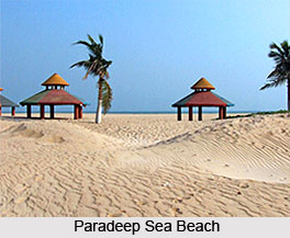
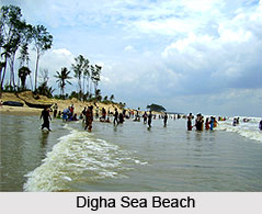
There are many beautiful beaches along the bay. Cox`s Bazaar, on the north eastern shore of the bay, is one of the longest continuous natural beaches of the world. Other beaches by the side of the bay include Bakkhali, Digha, Chandipur, Puri, Waltair and Marina Beach in India. The region has many sacred sites like the Kumari Kandam, the remains of the Sri Vaisakheswara Swamy temple, the Seven Pagodas of Mahabalipuram and the Ramanathaswami Temple at Dhanushkodi. Another significant site, which has been conserved, is the Vivekanandar Illam. In the year 1897, Swami Vivekananda`s legendary lectures were recorded here at Castle Kernan.
The Bay of Bengal was an important centre for British trade. One of the first business enterprises along the Bay of Bengal was of the British East India Company. Gopalpur was one of their major trading centres. The bay provides a means of livelihood for numerous fishermen. Fishermen can catch around 26 to 44 species of marine fish. The average catch is 2 million tons of fish per year from the Bay of Bengal alone.


