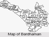
 Bardhaman is a city located in the Bardhaman District in the Indian State of West Bengal in the eastern part of the Indian subcontinent. It is in fact the headquarters of the Bardhaman District.
Origin of name of Bardhaman
The city is named after the 24th Jain monk, Tirthankar Mahavir Bardhaman. Bardhaman is also known as Burdwan or Burdhamn. During the Mughal rule, name of the city was Sharifabad.
History of Bardhaman
Bardhaman has been a district capital from the time when the Mughals ruled the place. Soon after it became a district headquarter of British India. Burdwan is another name by which the city is also known. The name was acquired during the British period and is still often in use. Burdwan is an anglicised adaptation of the Sanskrit Vardhamana and the corresponding Bardhaman in Bengali. It was at Bardhaman that Sher Afghan, husband of Nurjehan lived as a Jagirdar. He was anxious to bring his wife to his harem, for which he deputed Kutubuddin (as his Subedar) to Bardhaman. Ultimately both Sher Afghan and Kutubuddin were killed in a fight somewhere near the present Burdwan railway station. The two graves are seen lying side by side in Burdwan. The handover treaty of the three villages of Sutanuti, Gobindapur and Kolkata were signed between the East India Company and the Mughals at Bardhaman. Later the East India Company went on to rule India. These three villages grew up to be known as Kolkata or Calcutta today.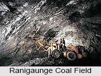
Geography of Bardhaman
The exact location of Bardhaman is 23.25 degree North and 87.85 degree East. It has a mean elevation of 40 metres (131 feet). The city is located slightly less than 100 km north- west of Kolkata, the capital of the state of West Bengal. It lies on the Grand Trunk Road (National Highway 2) and falls on the route of the Eastern Railway. The chief rivers are the Damodar and the Banka nala. The main rivers of the district are Ajay, Bhagirathi or Hooghly, Damodar and Barakar. In the district 30,949 hectares of the total land are covered by forest. These forest areas are broadly classified into Reserved Forests, Protected forests and unclassified state forests and lands.
Demography of Bardhaman
As per the 2001 census, the population of the district is 6.91 million. The sex ratio of Bardhaman is 921 females per 1000 males. The density of the population was 985 per sq. km. Bengali language and Hindi languages are the main languages spoken in the district.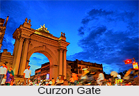
Economy of Bardahaman
Bardhaman is predominantly an agricultural district, which is properly known as the granary of West Bengal. Most of the people depend on agriculture. The district of Burdwan is predominantly agricultural in its eastern part and highly industrialized in the western regions. There are about 194 coalmines within its jurisdiction. The coals are being mined in Raniganj Coalfield since the year 1800. There are vast reserves for superior non-coking and inferior quality coals in these areas. Good quality fire clay occurs in the Barakar stage of the Raniganj coalfield. Besides, the fire clays, pottery clays and brick clays are also available. The principal commodity for trade in Bardhaman is rice. Rice is exported to other neighbouring countries. The district has a very good network of Irrigation facilities. The main sources of irrigation are Government canals, tanks, wells and tube wells. Asansol, which is a subdivision of the district, is one of the major industrial regions in the state of West Bengal. The most important of which is Durgapur, which has been built up as an industrial complex of the state. A large number of large sized industries have come up in the Durgapur Township. Besides, three important steel works are found at Kulu, Hirapur and Burnpur. Likewise, locomotive works at Chittaranjan, a big aluminum works at J.K. Nagar, a large paper mill at Raniganj are the important industries that deserve mention.
Education in Bardhaman
The number of Higher Secondary institutions per ten thousand populations in the urban area of Bardhaman is 0.65. The number of Secondary school per ten thousand populations for the entire district is 1.05. The district figures for Junior Secondary/Middle and Primary institutions per ten thousand populations in the urban sectors of the district are 1.35 and 4.17 respectively. The famous Bardhaman University started on the 15th of June 1960. Sukumar Sen, an ICS, was its first Vice-chancellor. After the ending of the Zamindari system in the fifties that Uday Chand Mahtab, the last spokesperson of the Burdwan Raj, showed his high-mindedness in leaving almost his entire property of Bardhaman at the disposal of the state government. This, together with the initiative of the then Chief Minister of West Bengal, Dr. Bidhan Chandra Roy, assisted the establishment of this university. There are many schools in the town. Some of them are the Kendriya Vidyalaya Burdwan, the Raj Collegiate School, the Burdwan CMS High School, the Ramkrishna Mission Saradapith, the Holy Rock School, the East West Model School, the Bidyarthi Girls School, the Burdwan Municipal Girls` High School and the Burdwan Town School. The colleges include Maharaj Bijoy Chand Institute of Engineering, the Burdwan Medical College, the Burdwan Homoeopathic College, the Vivekananda Mahavidyalaya, the University Institute of Technology, the Maharaj Uday Chand Women`s College, the Burdwan Raj College and the University Law College. 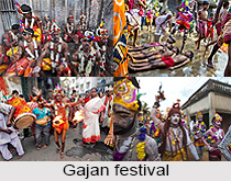
Tourism in Bardhaman
There are many places of interest in Bardhaman. In this town is located the renowned Shrine of Sarvamangala, which is believed to contain a remnant of Sati`s body, the umbilicus. Apart from this, there are also a large number of temples and Sivalingams. Other spots of tourist attraction are the Curzon Gate erected in honour of the visit of Lord Curzon and the palaces and gardens of the maharaja Golapbag. A number of tanks are scattered here and there throughout the town. These tanks interested Victor Jacquemont, a young French natural scientist, who came to this town in November 1829. At Nawab Hat, at a distance of about two miles from this town, is a group of 108 Siva lingam temples built in the year 1788. In the small village Panchkula in Bardhaman the Gajan is celebrated with a lot of enthusiasm during the month of May- June. The town also has a planetarium named after India`s reputed scietist Meghnad Saha. It is the second planetarium of the state, the first being the "Birla planetarium" in the city of Kolkata. There is also a village called Arraha in the Bhatar Block where a very well known festival called "Dharmarajer-Gajan" is celebrated. On the national highway that links Burdwan to Siuri, there is situated the famous 108 Shiva Temple, where the festival of "Maha-Shivratri" is celebrated each year over a span of one week with great zeal. Bardhaman is home to the two delicious sweets of "sitabhog" and "mihidana", which were first prepared in honour of the Raj family. Langcha, a sweet from Shaktigarh is another local masterpiece.
