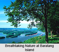
 Baratang Island, located in the Andaman Islands of the Indian Union Territory Andaman and Nicobar Islands, is famed for hosting the only examples of mud volcanoes in India. It encompasses an area of 238 square kilometres and forms one of the main islands of the Great Andaman group in the Bay of Bengal. In fact it forms a gateway to the North and Middle Andaman district. The mud volcanoes of the island erupt occasionally; however the recent one was recorded in the year 2005 which is believed to be associated with the 2004 Indian Ocean earthquake. These volcanoes are called as `jalki` by the local folks. The place is quite unexplored and thus has still retained its pristine natural beauty.
Demography of Baratang Island
Baratang Island is inhabited by the people belonging to Jarwah tribes who have short stature, dark complexion and reddish eyes. These people live away from the civilization and their freedom is ensured by the Government of India. Providing food items to them by the tourists is prohibited as spicy food does not suit their health. Andaman Adi Janjati Samiti or the forest department provides them clothes. In fact interacting with the Jarwahs by the tourists is also prohibited as there are reports of their attacks on the tourists.
Tourism in Baratang Island
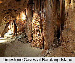
 Baratang Island flaunts the splendours of nature and hosts a wondrous coastline sheltering a rich diversity of marine life. Nayadera, Rogalchang and Baludera are the prominent beaches of Baratang Island. Mangrove creeks and thick tropical forest dot the island. It is a paradise for adventure lovers where activities like scuba diving, snorkelling, bird watching, beach tours, island camping, creek safari and jungle trekking can be relished. Tropical forest, Parrot Island and Limestone Caves are the added attractions. The magnificence of Parrot Island can be experienced during the sunset when numerous parrots returning to their nests create a majestic scene. The ancient Limestone Caves can be reached through an enticing boat journey through the dense mangroves. These caves are very dark and torchlight is needed to visit it. Baludera is a deserted beach of Baratang Island which displays its own charm. Mud volcanoes in the island keep on squirting forming another attraction.
Visiting Information
Baratang Island is an exquisite place for nature lovers where some of the spectacular landscapes can be experienced. It is located at a distance of 90 kilometres from Port Blair. Ferry can be availed from Nilambur Jetty to reach Baratang Island. Package tours can also be availed by the visitors.


