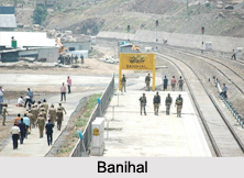
 Banihal is a town and a notified area committee in Ramban district in the Indian state of Jammu and Kashmir.
Meaning of Banihal
"Banihal" means blizzard in Kashmiri language. In some older texts it has also been referred to as "Devgol" (The abode of mystical giants).
Location of Banihal
Banihal is located about 35 km (22 mi) away from Qazigund of Anantnag district on NH 1A highway. However, the distance between Banihal and Qazigund is only 18 km by train on the new railway line which is much shorter than the road. Population of Banihal is mostly Muslim (over 95%).The most common language spoken in the region is Kashmiri, Urdu and English being other familiar languages.
Geography of Banihal
Banihal has an average elevation of 1,666 m (5,466 ft). It is a rural and a hilly area with Kamirwah being one of the most spectacular hills. Banihal means blizzard in Kashmiri language. Another view regarding the origin of the name of the place is that the word `Banihal` has actually been derived from two Kashmiri words viz ` bah ` meaning twelve and ` nallhe ` meaning a rivulet. Twelve rivulets signifying the various brooks flowing through the area and eventually joining the small local river called Nalla bischlari. There is a yet another school of thought amongst the locals and some scholars in which the word banihal is thought of as having a Persian origin. "Nihal" in Persian means greenery and hence, Banihal would imply `Eternally green`.
Demography of Banihal
The Banihal Municipal Committee has population of 3,900 of which 2,453 are males while 1,447 are females as per report released by Census India 2011. The population of Children with age of 0-6 is 388 which is 9.95% of total population of Banihal (MC). In Banihal Municipal Committee, Female Sex Ratio is of 590 against state average of 889. Moreover Child Sex Ratio in Banihal is around 902 compared to Jammu and Kashmir state average of 862. Literacy rate of Banihal city is 83.77% higher than state average of 67.16%. In Banihal, Male literacy is around 91.33% while female literacy rate is 70.31%.
Banihal Pass in Banihal
Banihal Pass is located at 2,832 m (9,291 ft) elevation of the Pir Panjal Range connecting Banihal with Qazigund on the other side of the mountains. The Pir Panjal mountain range separates the Kashmir valley in the Indian state of Jammu and Kashmir from the outer Himalaya and plains to the south. After closure of the Murree-Muzaffarabad-Srinagar road on partition of India in 1947, Banihal pass was the only passage from Jammu to Srinagar of Srinagar District of Jammu and Kashmir, after independence until 1956 when Jawahar Tunnel was bored through the Pir Panjal range.
Visiting Information
Banihal is accessible only in summer and remains closed rest of the year due to heavy snow. Banihal is divided into 7 wards for which elections are held every 5 years.
Related Articles
Cities of Jammu and Kashmir
Jammu and Kashmir, Indian State
Costumes of Jammu and Kashmir
Ramban District
Srinagar
Kashmir
Kashmir Valley
Indian Railways
Kashmiri Language
