Balaghat is situated in southern part of Jabalpur division. The district spans over a degree from 21.19` to 22.24` North and 79.31 to 81.3` East. The district occupies an area of 9245 Sq. Km. Balaghat is bounded by Rajnandgaon in the East, Seoni in the West, District Mandla in the North and Bhandara of Maharashtra State in the south.
Origin of name of Balaghat
The headquarters of Balaghat was "Burha" or "Boora". In later years, this name fell into disuse and was replaced by "Balaghat".
History of Balaghat
In the beginning of 18th century, the district was divided amongst two Gond Kingdoms. The portion of the district west of the Wainganga was part of the Gond kingdom of Deogarh while the eastern portion was part of the Garha-Mandla kingdom. In 1743, Deogarh kingdom was annexed by the Bhonsle Marathas of Nagpur.
In 1818, with the end of the Third Anglo-Maratha War, Balaghat District was then divided among the British districts of Seoni and Bhandara.
Balaghat District was constituted during 1867 by amalgamation of parts of the Bhandara, Mandla and Seoni districts. Administratively, the district was divided into two tehsils, Baihar tehsil and Balaghat tehsil. Colonel Bloomfield, the first Deputy-Commissioner of the district encouraged the settlement of Baihar tehsil.
In the 20th century, the district had only 15 miles of paved roads, together with 208 miles of unpaved roads. In 1956, Balaghat District became part of the Jabalpur Division of Madhya Pradesh, where the districts to the south of Balaghat, including Gondiya, Bhandara, and Nagpur districts, were re-located to Mumbai.
Demography of Balaghat
As per the 2001 Census, the total population of the district is 14,97,968 out of which 12,36,083 is rural and 1,29,787 is urban population. Out of the total population, 1,13,105 are Scheduled Caste and 2,98,665 are Scheduled Tribes. The population density of the district is 148 persons per sq. km. The sex ratio is 1003 females per 1000 males.
Economy of Balaghat
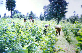 Balaghat is rich in forest wealth. Balaghat is the second highest producer of sericulture in the State. Sericulture is a small-scale industry in rural areas and has an agro forestry base for generating revenues of self-employment. There are two types of Sericulture Industry in Balaghat. They are tasar and mulberry.
The district is rich in minerals as Copper, Manganise Dolomite, Marbal etc. Minor minerals as Bauxite, Kyanite and Limestone are also found in the district. There are 48 mineral mines here. About 80% of the Manganese production of the country comes from Balaghat. The recent discovery of Copper deposit at Malajkhand is regarded as the largest in the country. There are rice mills, poha mills in Balaghat.
Fauna and Flora of Balaghat
Balaghat is known as hunter`s paradise due to its varied fauna. The fauna of the district are Tigers, Leopard, Bear, Neel-Gai, Deer & Bison on one side and birds like Peacock, Red Bulbul and Koyal on the other.
Balaghat has a very rich forest base. The major trees found here are Teak, Sal, Bamboo and Saja. Vegetables found in abundance in the district are Potato, Onion, Ladies Finger, Tomato, Beans, Cabbage, Flower Cabbage, and Carrot. Fruits like Mango, Orange, Lemon, Kathal, Amrud are also grown here.
Transportation of Balaghat
The district is connected by bus, air and rail. Bus connects important places such as Bhopal, Nagpur, Gondia, Jabalpur, Raipur etc. The nearest Airport is at Nagpur. South East Central Railway runs north and south through the district, along the valley of the Wainganga.
