Home > Indian History > Geography of India > Bagmati River
Bagmati River
Bagmati River is one of the snow fed rivers, which is dying for the accumulation of garbage by the people.

Share this Article:

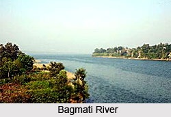
Bagmati River, BiharBagmati River is one of the snow fed rivers which is considered holy by Hindus and Buddhists. The bank of this river enshrines a number of Hindu temples. Bagmati River finds mention as Vaggumuda in Vinaya Pitaka and Nandabagga. It also finds mention as Bahumati in Battha Suttanta of Majjhima Nikaya.

Origin and Course of Bagmati River
It originated where three headwater streams meet at Baghdwar above the southern edge of the Shivapuri Hills about 15 kilometers northeast of Kathmandu. The river flows southwest through terraced rice fields in the Kathmandu Valley. The flow gets interrupted in various places, including at Pashupatinath Temple, due to resistant rock strata.

Beyond the temple, the river flows south then turns west and then enters Kathmandu`s urban area. Then again Bagmati turns south and the Vishnumati enters from the right at Teku Dovan.

After flowing south with many curves, the river reaches the edge of the Kathmandu Valley and enters Chobar Gorge near the Dakshinkali temple complex. Then Bagmati crosses the lower Sivalik Hills before reaching the Terai, and then crosses into India at Dheng. The river flows across Bihar districts Sitamarhi, Sheohar and finally Muzaffarpur.

Religious Significance of Bagmati River
Bagmati River holds a prominent position amongst the Hindus. Hindus are cremated on the banks of this holy river, and Kirants are buried in the hills by its side. As per the Hindu tradition of the Nepalese, the dead body must be dipped three times into the Bagmati River before cremation. The chief mourner also takes a holy river-water bath immediately after cremation. It is believed that the Bagmati River purifies the people spiritually.

Temples on the Banks of Bagmati River
The banks of this holy river shelter various temples. The temple of Pashupatinath is nestled on an outcrop above the river north of Kathmandu. It is regarded as one of the holy places of Hinduism. Gokarneswor temple located at the north of the Kathmandu Valley is also an important holy shrine.

Threats to Bagmati River
The water of Bangmati River in Bihar faces lots of challenges due to solid waste, industrial effluents, encroachment and rampant construction along the banks. The river receives large amounts of untreated sewage and large levels of pollution in Kathmandu as well. However, in 2014, it was declared that the river is clean after a long effort of 14 years.


Share this Article:

Related Articles

More Articles in Geography of India


Geography of Uttar Pradesh
The fourth largest State in India UP is located in the Northern part of India whose area is 2,36,286 sq Kms.
Geography of Maharashtra
Covering an area of 308,000 sq. km, Maharashtra, the third largest state in India.
Geography of Kerala
Geography of Kerala includes plains, hills, valleys and coasts. With the Arabian Sea in the west, the Western Ghats in the east and networked by several rivers, Kerala enjoys diverse geographical features.
Geography of West Bengal
The geography of West Bengal is unique with high peaks of the Himalayan range in the north, the Bay of Bengal in the south and the remaining region is covered with both plains and plateaus.
Geography of Jharkhand
Geography of Jharkhand is comprised of the rich mineral resources and the highly agricultural prospect in this state.
Geography of Sikkim
Geography of Sikkim is characterised by a vast array of magnificent hillock that extends from one corner of the state to the other.
Geography of Meghalaya
The suitable climate, highland plateaus, rivers and the flora and fauna together forms the geography of Meghalaya.
Geography of Mizoram
Mizoram is surrounded by hills, valleys, rivers, waterfalls and lakes. The hills range from 1000 meters to 2000 meters. Rivers, lakes and waterfalls also play major role in forming the land of Mizoram.
Geography of Jammu & Kashmir
Jammu and Kashmir is encompassed by valleys. Some of the dominant valleys of the state are Kashmir Valley, Tawi Valley, Chenab Valley, Poonch Valley, Sind Valley and Lidder Valley etc. Jhelum River is the only major Himalayan River which flows through the Kashmir valley. Indus, Tawi, Ravi and Chenab Rivers are the major ones flowing through the region.
Geography of Daman and Diu
Daman and Diu is situated on the west coast of India and are the smallest union territories of India.
Geography of Goa
Geography of Goa occupies a prime location along the Konkan coastal belt on the western coast of India. The state is bordered by Maharashtra in the north and Karnataka in the south. The Western Ghats in the east contribute to the flora and fauna of Goa.
Geography of Arunachal Pradesh
Geography of Arunachal Pradesh reveals that it is a hilly tract nestled in the foot of Himalayas.
Geography of Kutch
Geography of Kutch District is covering an area of 45,612 km. Kutch District is the largest district in the state of Gujarat.
Geography of Ladakh
Geography of Ladakh mainly comprises the huge Karakoram Range with long stretch of cold desert which mark the region separately from the rest of the states of Indian subcontinent. Surrounded with the mountain ranges from all corners this small region separates Indian subcontinent from rest of the Asian continent.
Geography of Rajasthan
Geography of Rajasthan defines the dry topography with arid climate of the western mountain region.
Geography of Tamil Nadu
The Indian state of Tamil Nadu is located in the Northern hemisphere in the hot zone.