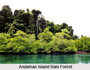
 Andaman Islands rain forests are one of the best ones among all the eco-regions in India. The Islands are located between the Bay of Bengal and the Andaman Sea, and they are affiliated with both the countries like India and Myanmar, in important ways. The Andaman Islands rain forests are relatively intact and are quite similar to the other rain forests in India. The tall and major timber trees like gurjun dominate the hill forests in this wet climate and the southern islands are more favourable to a different type of dipterocarp. The monsoon areas in the Andaman Islands are characterised by shade trees called padauk and the Terminalia genus of trees.
The Andaman Islands rain forests are located in the eastern Indian Ocean, as part of the Bay of Bengal. The climate of the forests is warm tropical, and the temperatures range from 22 to 30 degrees Celsius. The average annual rainfall in the forests ranges from 3,000-3,800 millimeters and the rainfall is heavily influenced by monsoons. Monsoons usually come in the Andaman Islands rain forests, from the southwest (May to September) and from the northeast (October to December). The forests are geographically part of the long island arch that runs from Arakan Yoma in Myanmar to the Mentawai Islands off Sumatra.
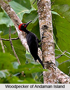
 The Andaman Islands rain forests are home to numerous species of flora and fauna and also contain rich natural vegetation. The main categories of natural vegetation in the Islands are coastal and mangrove forests and the interior evergreen and deciduous forests. The Andaman Islands evergreen forests form on clayey loam soils with poor humus content on top of the micaceous sandstones. Some of the dominant tree species in these forests include Dipterocarpus griffithii, D. turbinatus, Sideroxylon longipetiolatum, Hopea odorata, Endospermum malaccense, and Planchonia andamanica and they can reach heights of 40-60 m. Apart from that, the Andaman Islands rain forests are also home to eight species of endemic birds, most of which take the name of the archipelago. Some of the most important species include the Andaman woodpecker, Andaman Drongo, Andaman Treepie, Andaman Cuckoo-Dove, Andaman Wood Pigeon, Andaman Serpent-Eagle, and Andaman Scops Owl, etc. The forests also provide the only habitat for a few small, endemc mammals, three shrew species, a bat, and a rat.
The endemic and near-endemic mammal species found in the Andaman Islands rain forests include the families like Sorcidae, Rhinolophidae, Muridae, etc. All of the above mentioned mammal species are strictly endemic to the ecoregion and the species are listed as threatened, as well. Apart from that, there are also eight strictly endemic bird species and four near endemics found in the Andaman Islands rain forests. The species include the families like Accipitridae, Rallidae, Columbidae, Columbidae, Cuculidae, Strigidae, Bucconidae, Picidae, Dicruridae, Corvidae, Sturnidae, etc.
There is a bird species named the Megapodius nicobariensis (Nicobar Scrub fowl) that was used to be found in the Andaman Islands rain forests. One of the strictly endemics like the Aceros narcondami is declared as threatened in the IUCN categories VU and above. The Andaman Islands Rain Forests houses forty-five reptile species, out of which, thirteen are considered as endemic. Another twelve amphibian species (all frogs and toads) are also found in the Andamans and seven of them, are endemic. The genera Dipterocarpus and Pterocarpus are also quite commonly found in the forests.


